September 2018
I’d had the Cumbria Way on my list for a while and with a week booked off work for a UK-based adventure I thought it might be time to revisit the idea. The Cumbria Way sticks mostly to the valleys so I thought I’d edit it to make my own ‘High Cumbria Way’ route going up more of the fells (not an original idea). Due to the extra distance this would add, I planned to finish in Caldbeck at the end of the Lake District National Park, rather than the traditional further end of Carlisle. The plan was to be flexible; if the weather or my legs made the summits less attractive, then I’d stay on the low-route.
Day 0: To Ulverston
A bus and 3 trains on the bank holiday Monday saw me reach Ulverston in the afternoon, and I checked into my guest house. I hadn’t managed to find a handy campsite in Ulverston and it was the only one that wasn’t eye-wateringly expensive. I went food shopping for the trail and de-packaged everything back in my room. I was experimenting with going stoveless – it was less fuss, less to carry, and I’d be able to get hot food/drink most days anyway. But would I miss a hot breakfast and dinner? Typically, I packed far too much food for what I needed.
Day 1: Ulverston to Coniston
25km
After a delicious cooked breakfast, I headed out to find the start of the Cumbria Way. I’d follow it to Coniston, from where I would divert up the fells. The skies were grey but without rain for me, so it was pleasant walking weather and not too hot. Almost immediately the Way went through a field of cows and I groaned internally (and possibly externally). I approached with caution but they weren’t interested in me, so I continued on, stomping merrily in the literal river of cow pats through the farm.
There were no big fells on the first day but it was a good leg opener up and down some steep small hills. The Way had been diverted a few times compared to the map, but I followed the signs where possible. The map was definitely needed however, as in some cases the signposts disappeared at crucial footpath junctions. I grazed on blackberries throughout the day as I passed full hedgerows of them, ripe from the hot spring and summer.
I stopped for about an hour over lunch, perched on a hillside looking back towards Ulverston and the sea, attempting to make a dent into my over-the-top food supplies. As an afterthought I rang the campsite in Coniston to make sure I could stay.
“When do you think you’ll get here?”
“Uh, about 4pm? I’m walking to you.”
“You’re what?”
Booked in, I set off as a runner came round the corner. It transpired she was recc’ing the route for the Cumbrian Way ultra race in a few weeks. We chatted for a bit but she seemed not to notice that I was walking at a slower pace than she was running, so her words got fainter as she pulled away. I caught up with her a bit later when I had to check the route – she said she had a map buried in her small backpack, but seemed to prefer taking my word for it.
Descending past a tarn the southern fells loomed into view, like gatekeepers to the ‘proper’ Lake District. I took another leisurely lie down by Coniston Water and watched the boats go round in circles. The lakeshore got busier as I proceeded north, as families played in the shallows and activity centres rigged dinghies.
I left the shore to climb up to the campsite – it was mostly a caravan site with a few tent spots, so they weren’t set up for many backpackers and didn’t have a kitchen area or anything, but they did have a great pizza van on site.

Day 2: Coniston to wild camp
18km
The forecast had been for rain early morning so I had a lie in until it stopped, then headed into Coniston for breakfast (a cream tea). With the skies clearing it was pretty hot by mid morning as I sweated my way up the Walna Scar Road to Brown Pike. I sat in the wind shelter at the top for about an hour, looking south over the water and munching on dried mango and peanut M&Ms. I was in no rush as the plan was to wildcamp later and with it not getting dark until after 8pm I didn’t want to pitch my tent much before then, which would have made for a very long day if I kept walking. Instead, I reveled in the slow travel and the small things. Like why were there dozens of crane flies in this rock shelter?
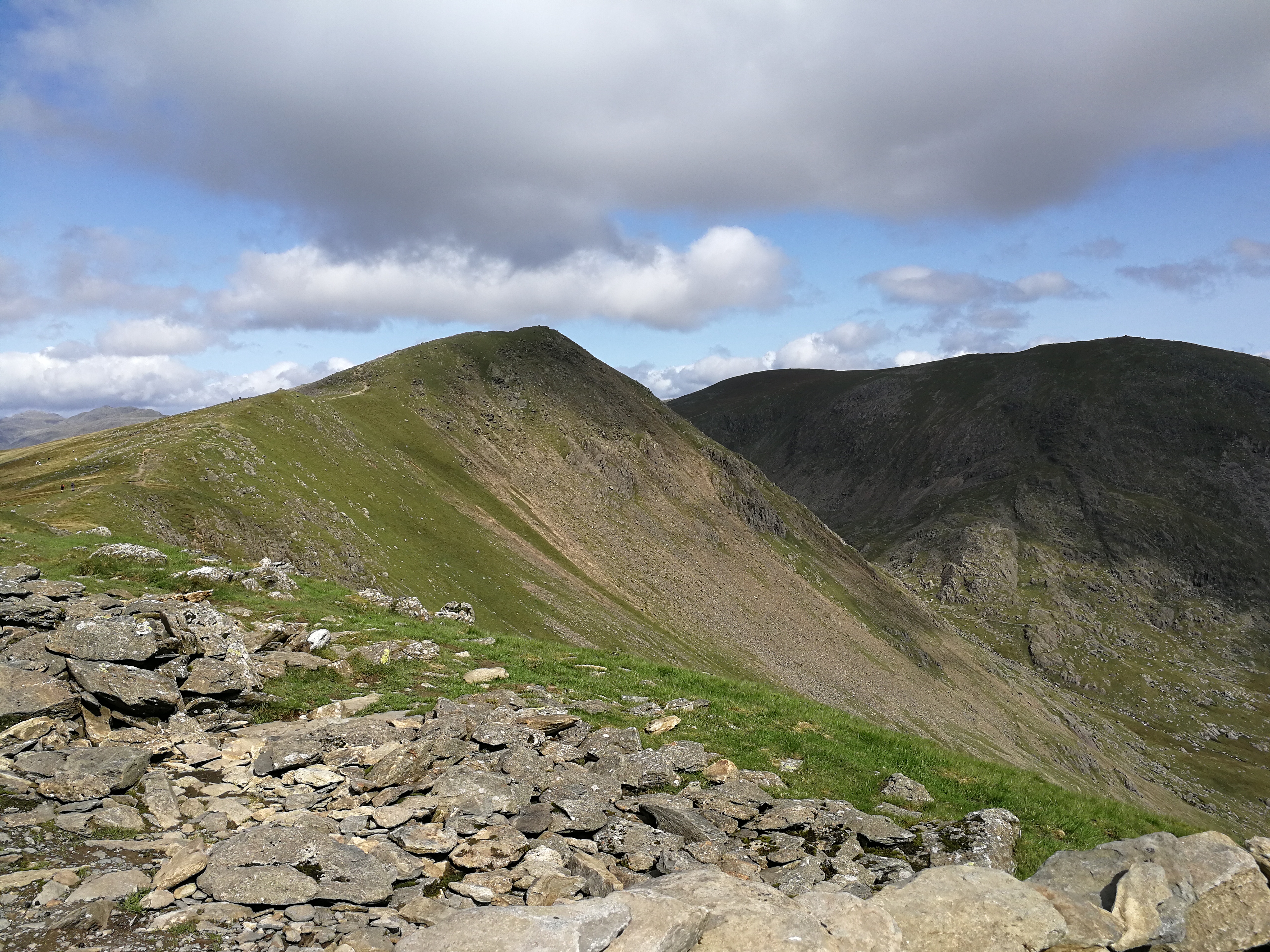
I dawdled on along the ridge over Buck Pike and Dow Crag, before descending and re-ascending along the adjacent ridge to Swirl Howl. I looked back and a small rain shower was passing over Dow Crag, but I remained in the sun.
I descended to Wrynose Pass, watching cyclists in the distance zig-zag up the steep pass throwing off long shadows from the setting sun, before heading up the final climb of the day. The wind had picked up and was quite a strong northerly which I hadn’t expected so was worried that my planned wild camp location would be rather exposed from the north, but I found a sheltered spot that wasn’t boggy either.
I ate dinner before putting the tent up as the last of the day walkers came off the mountains, and filtered water from a stream to refill my bottles. I left some spare in the Cnoc bladder so I wouldn’t need to fetch more water in the morning but could filter it from my tent.
The skies had cleared and I watched them tinge with pink before I retreated to the shelter of my tent.

Day 3: Wild camp to Stonethwaite
16km
I slept fairly well once my brain stopped picking up every rustle outside, and I woke up cold in the middle of the night so layered my down jacket over my sleeping bag and soon warmed up. I packed the tent down by 7am and ate breakfast as the sun came over the peaks, warm enough as the wind had died overnight to nothing.
I’d had a half mind to loop in Scafell Pike on the way down to Stonethwaite, but that was quickly scrapped after the repeated climbs over Crinkle Crags, Bowfell and Esk Pike drained my legs. I didn’t see anyone for the first 4 hours and it was almost eerily quiet. I savoured the silence and the views from the tops of Crinkle Crags and Bowfell.
As I dropped to the cross roads below Esk Pike, a teenager approached me.
“Excuse me, do you know which one is Scafell Pike?”
“Do you not have a map?”
“No…” he replied, with the audacity of a cheeky grin. I sighed, contemplated sending him and his friend up Esk Pike, but pointed out the path to Scafell. After seeing no one all morning the trail leading across to Broad Crag and Scafell Pike were relatively busy, and I ducked across to Glaramara where I stopped for a second lunch.
The descent to Stonethwaite seemed to never end, and my knees were grateful when the path eventually flattened out at the valley bottom.
I set my tent up at the campsite and had a shower before heading to the cosy Ingleborough pub, where I’d eaten at last year on my Coast to Coast walk.

Day 4: Stonethwaite to Skiddaw House
25km
I’d had two pretty big days of elevation so was planning on sticking to the Cumbria Way in the valley and along Derwent Water, but when I woke up it was a beautiful sunny day, which meant I had to get up on the tops again.
The path by the gentle river Derwent was gorgeous in the dappled shade and I had breakfast there rather than in the campsite. I climbed up through the quarries around Tongue Gill, taking a break in the shade behind an old ruined building as it was getting pretty hot out of the wind.
I stopped for elevenses on High Spy, and chatted to a couple of guys about where I’d been and camped. They were staying in a Borrowdale camping barn and doing day trips out. They carried on as I stayed for a while sunbathing and watching the wildlife.
By the time I’d descended off the hills I was looking forward to a cafe in Keswick on my way through to Skiddaw, but as I turned the corner and found a cafe at the activity centre in Nichol End, I took the early opportunity for a cream tea, a milkshake and an orange juice.
Keswick was a veritable hub of activity compared to the emptiness of the fells, and pretty as it was I didn’t linger (although I did get some cake to go for later…) and carried on through the town now back on the Cumbria Way. After an initial steep section to the base of Latrigg, the path contoured around the hills rising gently, providing a superb balcony walk in the late afternoon sun, with great views south looking back at where I’d walked from.
Eventually I rounded the final corner and Skiddaw House came into view, nestled in the uplands between Skiddaw and Blencathra. I met the lovely live-in wardens Suzy and Martin on arrival at the YHA affiliated hostel, and pitched my tent on a flat-ish freshly mown patch of grass within their boundary wall. I’d not seen any midges on the trip so far but I had to cover myself and get the bug spray out as I set my things up as quickly as possible then ran back to the safety of the house to escape from the masses. Probably all the bracken and heather.
I settled in the lounge next to the fire (but not too close, it was heating the whole ground floor so was pretty intense) and flicked through some of the walking books and guides on the bookshelves. After dinner the wardens and everyone staying gathered in the lounge with a few beers as we talked about walking and life at the off-grid Skiddaw House without electricity, wifi or mobile signal. It was great.

Day 5: Skiddaw House to Caldbeck
15km
The skies were clear again and the moon was really bright – I peered out in the middle of the night and it would almost have been light enough to walk by. I packed up pretty early then had a leisurely breakfast in the kitchen, helping myself to the free coffee. I bid the others a good day as they came down the stairs and I headed out onto the trail.
It transpired that today was also the date of the Skiddaw Ultra, a 45 mile trail race that set fell runners on a course for a loop of Skiddaw, including the section of the Cumbria Way that I’d be on. After a couple of hours of solitude heading north east along the valley, the first runner came loping round the corner. The route on the ascent next to Grainsgill Beck disintegrated somewhat into bog, so having the race signposts was actually quite useful. All the runners were courteous on passing, although it seemed like those at the front and the back ends were enjoying it the most. I had a chat with a marshal on the top, and remarked how they were much cleaner up here before the slip and slide down the boggy hill.
The blue skies had given way to rather dark clouds, with Skiddaw now obscured. I continued swiftly on over High Pike and Low Pike, trying to outrun a curtain of rain to Caldbeck. I was subjected to half an hour of drizzle at the end, which wasn’t bad for a week in the Lake District. I did a little limping run for the bus waiting in Caldbeck as it was 4 hours until the next bus and I wasn’t that keen to hang around in the riain. A rather rushed end to my High Cumbria Way, but plenty of time to reflect as I got a second bus to Penrith and two trains home.
I hadn’t missed my stove at all for this trip, I suspect because I had some form of hot meal or drink every other day – if it was for a longer period of time or fewer towns, then I might get bored of wraps and flapjack. It was definitely the most fells I’ve done in one stretch in the Lake District, and having all the time in the world to slow down and soak in the outdoors was wonderful. I’ve now done a west-east crossing and a south-north crossing, perhaps a circular tour next…?

Nicely balanced writeup . Have been thinking of doing a similar approach to the
Way , having done most of it over the years in bits and pieces . Hope you are still
enjoying your Scarp 1. Great tent – even better for Autumn /Winter trips .
Thanks! Yeah the Scarp was great – nice not to have to worry about the wind too much, and I packed it away wet most mornings from dew and the inner remained dry every time. Am considering the Notch though for the weight and pack size savings.