April 2016
Given my plans for extended periods of hiking alone I thought it would be a good idea to get some structured training on essential things like navigation, route planning, kit, and mountain-top selfies (just kidding, got that nailed). I booked a mountain skills training weekend at Plas-y-Brenin in Snowdonia.
I arrived late on Friday and due to train delays had missed the pick-up time for the minibus so had to get a taxi to the centre. As it turned out the taxi driver was a big hiker too, so we compared trips and summits on the way. On arrival I found out that my roommate-to-be had cancelled so I had a room to myself, which was welcome news as I had managed to wake up with a stinking cold.
I tend to judge accommodation heavily on how good the breakfast is. I’m a breakfast person. I wake up looking forward to breakfast. Luckily, the breakfast at Plas-y-Brenin did not disappoint. You could have a massive cooked breakfast, porridge, cereals, toast, fruit, yoghurt etc. As people glanced furtively around the tables, trying to judge who would be in their group, I got chatting to a woman who was doing a kayaking course. Maybe next time…
After a welcome talk by the instructors to everyone staying for weekend courses, we split into our groups for introductions and a bit of theory in the ‘classrooms’. There were 16 of us, and a fairly obvious split arose when we did a tour de table discussing what we wanted to get out of the weekend. Some were there to hone their navigational and mountain skills, others wanted a good walk and a good pint at the end. Both approaches were perfectly acceptable, and it meant an easy divide into 2 groups with an instructor each.
We got outside almost straight away, with our instructor testing our micro navigational skills from the get-go, and filling in our knowledge gaps. One aspect I’d never done before which I found useful was estimating how long it should take you to get to a point on the map – handy in poor visibility to check you’ve not missed a turn off or landmark. Having to pin-point exactly where we thought we were on the map was a good exercise as well, as it made you go through the deductive steps of using the terrain around you.
We did some drills for practicing taking bearings – stand back to back with a partner, choose a direction and take a bearing, walk 10-30 paces, drop your bag in the heather and gorse, return to your partner and tell them the bearing, and then they have to find your bag. This should have been pretty easy, but my partner gave a wrong bearing, and it turned out my compass was broken. Needless to say I didn’t find the bag. But it meant I could get a new compass back at the centre’s shop and use it on the second day, rather than discover this on a walk by myself.
When we arrived back I mentally gave more points to Plas y Brenin: afternoon tea and cake.
In the evening one of the staff gave a talk to the whole centre about his recent kayaking trip through Canada, and got some really cool GoPro shots along the rivers.
We started the second day in the classroom again, with a sheet map each of today’s mountain. We had to plan a route, and note key items along the way that might be useful for navigation. We got outside quickly, and took turns leading the way. A main message from the second day was not to blindly trust man-made objects on the map. Fences can be moved, walls knocked down, and houses built. Also be careful of forests on the map – as we found, large areas of these can be cut down – and rivers, as these can dry up or swell to much larger than on the map. In summary, be suspicious.
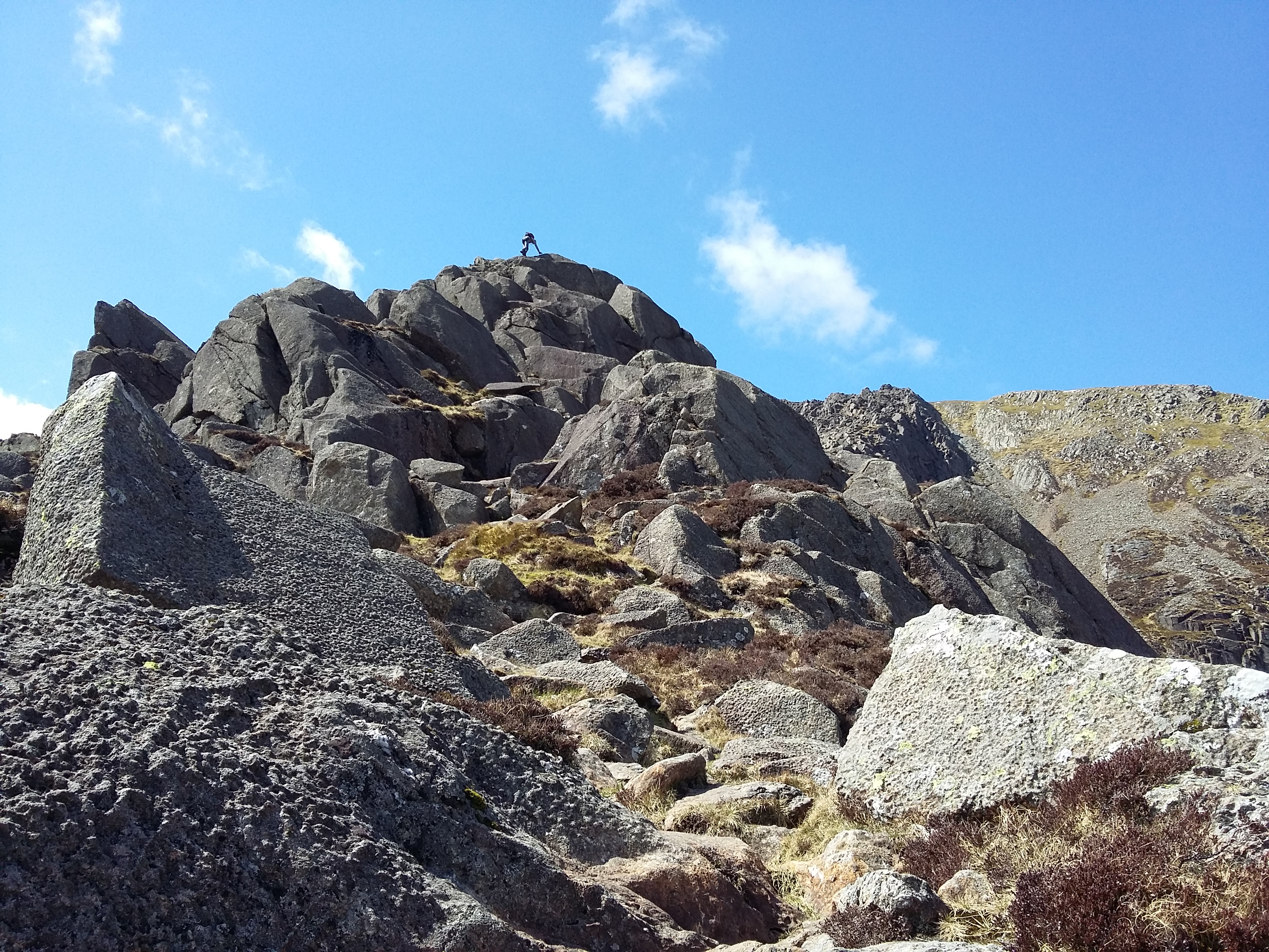
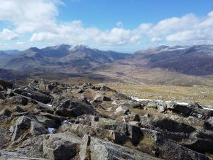
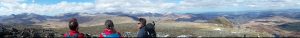
After lunch we had a super fun grade 0/1 scramble up to the summit of Moel Siabod. It was dry and not very windy, so it was pretty easy scrambling, but took about 20 minutes to get up it all. There was still some snow at the top, and after taking in the stunning views – almost all of the Welsh 3000s – we practiced deploying a group storm shelter. The temperature inside rose immediately, and there was enough room to put our bags in the middle. I always take an emergency bag/blanket with me, but I’d now think about taking larger shelters if out with a group.
We practiced some more micro-navigation on the descent, and discussed kit. I’d borrowed a GPS from the storeroom to try it out for the day – it had stayed in my bag most of the time, but it was quite reassuring to be able to get it out and check our position digitally.
With a final round of tea and cake whilst waiting for the bus to the train station and reflecting on a great weekend, I had a browse through the other courses on offer. Our group leader had suggested I should do the Mountain Leader training and qualification. Maybe one day…