February 2017
After spending a considerable amount of time down the rabbit hole of light/ultralight tents, I have finally bit the bullet and bought one: a Tarptent Scarp 1. It’s currently winging its way from the US so I’ll do a full review when it arrives (…and maybe when it stops raining). This was one of the tasks on my rather long ‘Get ready for Te Araroa‘ list. The next step is to actually get some decent hiking and camping under my belt this year, in order to shakedown kit, and because hiking makes me happy.
Due to the timing of Easter this year, it’s possible to take 9 days of leave from work and get 18 days away. Busy though it may be, that was too tempting to pass up. So, a 2-week-ish backpacking hike in the UK (saving monies)? Coast to Coast it is! I’ve had my eye on it for a while, and it ticks the boxes for length, location, pub-crawl-ability, and traversing a country which I’ve got a bit hooked on.
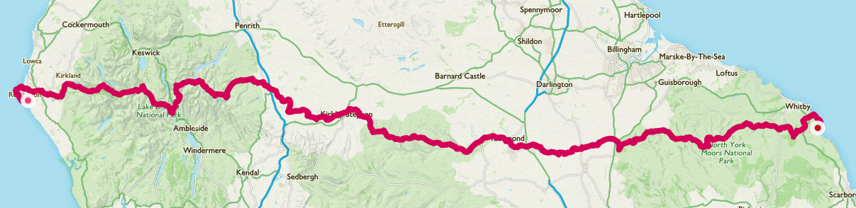
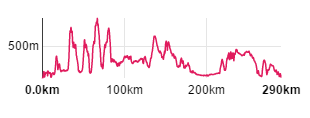
The Coast to Coast is roughly 190 miles long, and crosses 3 national parks, identifiable by the 3 groups of peaks in the elevation graph below.
One of the main issues with planning a Coast to Coast walks is booking accommodation – the route can go through some pretty small villages/towns with few options so booking in advance is a must. As I’ll be camping, this is made much easier, some of the campsites don’t actually take bookings and there’s the possibility of a couple of wild camps. This also means I’m less tied to a fixed schedule so can adjust my days as I go along. I’ll book my train ticket home a couple of days before the end when I’ve got a better idea of when I’ll arrive!
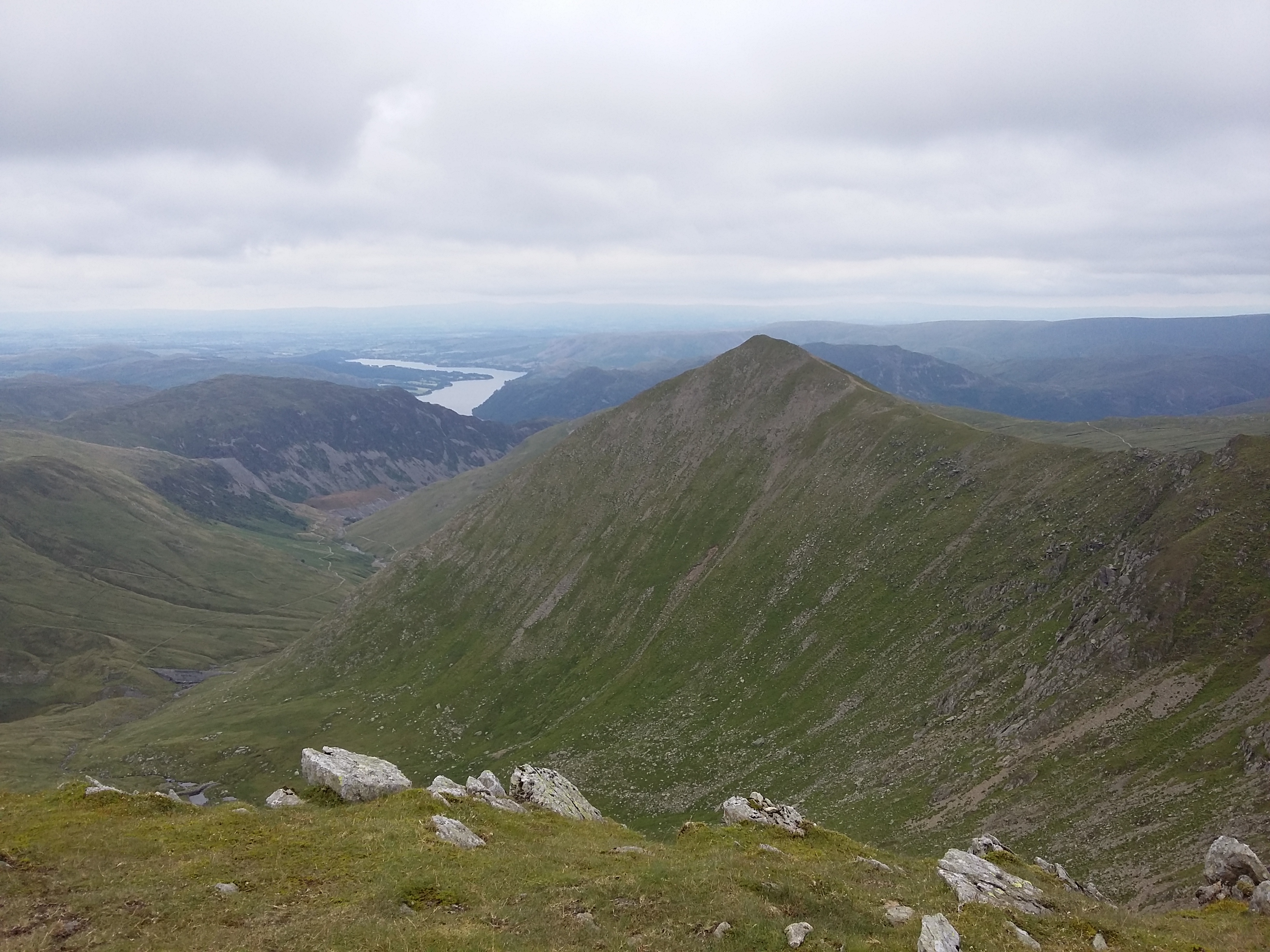
The current plan is to do it in 14 days. This is about middle-ing in terms of ambition – common approaches see it done in 12, 14 or 16 days. I’m adding an extra day in the Lakes, and breaking one of the really long later days into two. I’m also learning from previous mistakes, and building in a rest day half way through. I’ll be walking west to east which is the most popular direction. This means I’ll likely be crossing paths with the same people repeatedly, rather than meeting a wave of walkers going the other way around midday every day. It does mean the hardest and most stunning part of the walk is first, so some prefer to walk east to west. As with many other walks, I find Rambling Man‘s blogs very useful for planning.
The walk also ticks the box for navigation practice. The Coast to Coast is an unofficial route, and so there are no specific signs for the walk, and varying levels of waymarking from smaller trails. The two guidebooks I’ve got (Aurum Press’s and Cicerone’s) come with strip OS maps covering the whole route, so I’ll be relying on these and a compass where necessary. I sent Ordnance Survey a few lines for their 2017 #GetOutside competition, and as a way of saying sorry you didn’t win, I got a year’s membership of OS maps premium. This means I can download any OS map to my phone, so I’ll be having that as a backup.
Due to the popularity of the walk there have been some issues with erosion, particularly in the peaty areas. So I was happy to read the other day that funds have been raised to develop the paths in the Nine Standards Rigg area and conserve the land, and that Cumbria County Council have agreed to designate that section of the route as an official Right of Way.
Time to book the train north!
One thought on “Planning a Coast to Coast walk”