This section covers the Richmond Ranges (and the Kaikoura interlude). I’ve added some rough ascent and descent to the distance and time (hut to hut times).
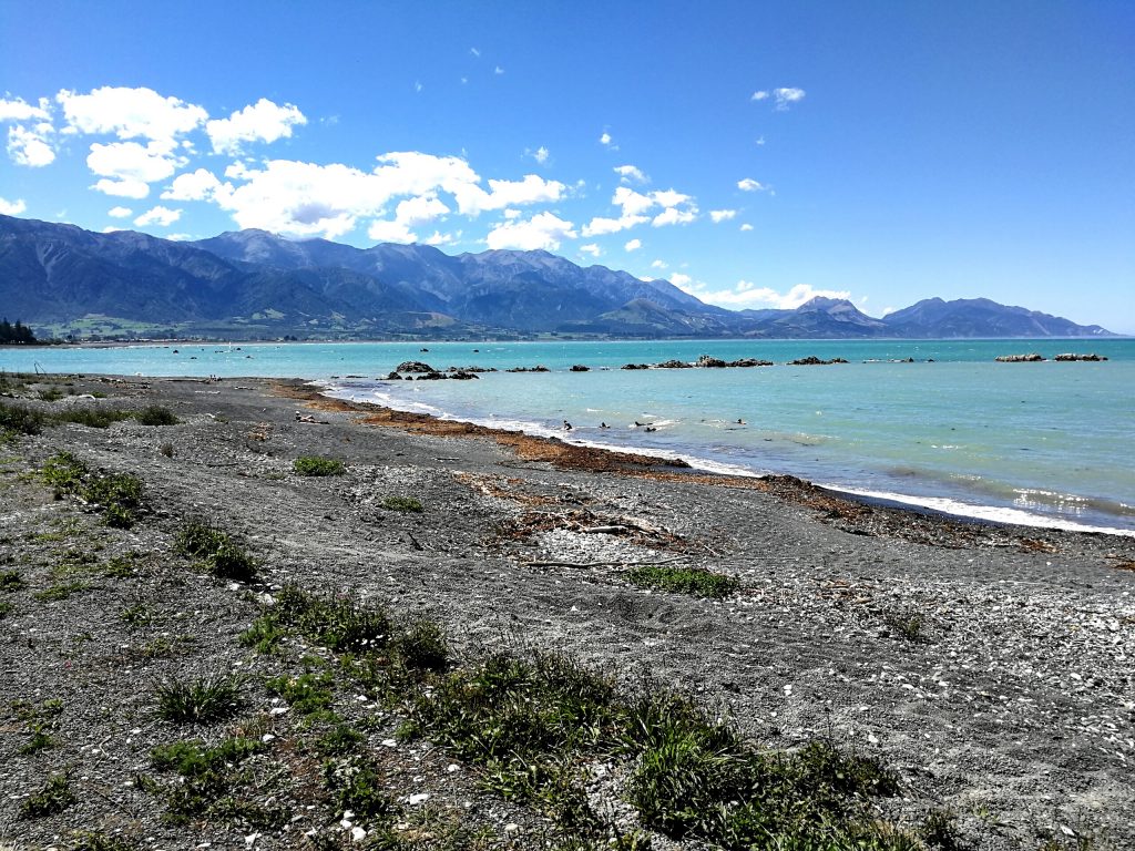
I had a gloriously sunny couple of days as a side trip in Kaikoura with Ali and Liv. After 30 mins of our thumbs out we got a hitch with Michael, 86, from Havelock to Blenheim Airport where we had a hire car waiting. Michael was lovely and mentioned a vineyard we should look out for on the drive down. We stopped off for some delicious wine tasting and a drive around the unusual coastal vineyard. The drive down was beautiful if slow due to the ongoing repairs after the big earthquake just over a year ago. We spent 2 nights in Kaikoura, with time on the beach, walking around the peninsula, ice cream eating and kayaking with seals. We drove back to Havelock the long way round, stopping in St Arnaud, and looked forward to walking back there in a couple of weeks. Although it seemed a long long way from Havelock!
Day 7: Havelock to Pelorus Bridge
21km, almost flat, 5.5 hours
As sod’s law would have it, the big storm we’d gone to the beach to wait out had weakened and slowed down a day or two, meaning that although it was dry when I set off from Havelock on Wednesday morning, it started raining at 11am and it didn’t stop for 24 hours.
I went ahead as the girls had to wait for the post office (in a pharmacy) to open to send things to a friend to lighten their packs. The first few km were on the shoulder of a fairly busy road (by New Zealand standards) but the trail soon turned off onto a gravel track. A logging truck came through sending clouds of dust into the air.
The trail was pretty flat so the going was quite quick, and I was leapfrogging 3 other hikers as we took breaks at different times. I also knew that when it started raining it wasn’t going to stop and was only going to get worse, so was keen to get as much dry walking in as possible.
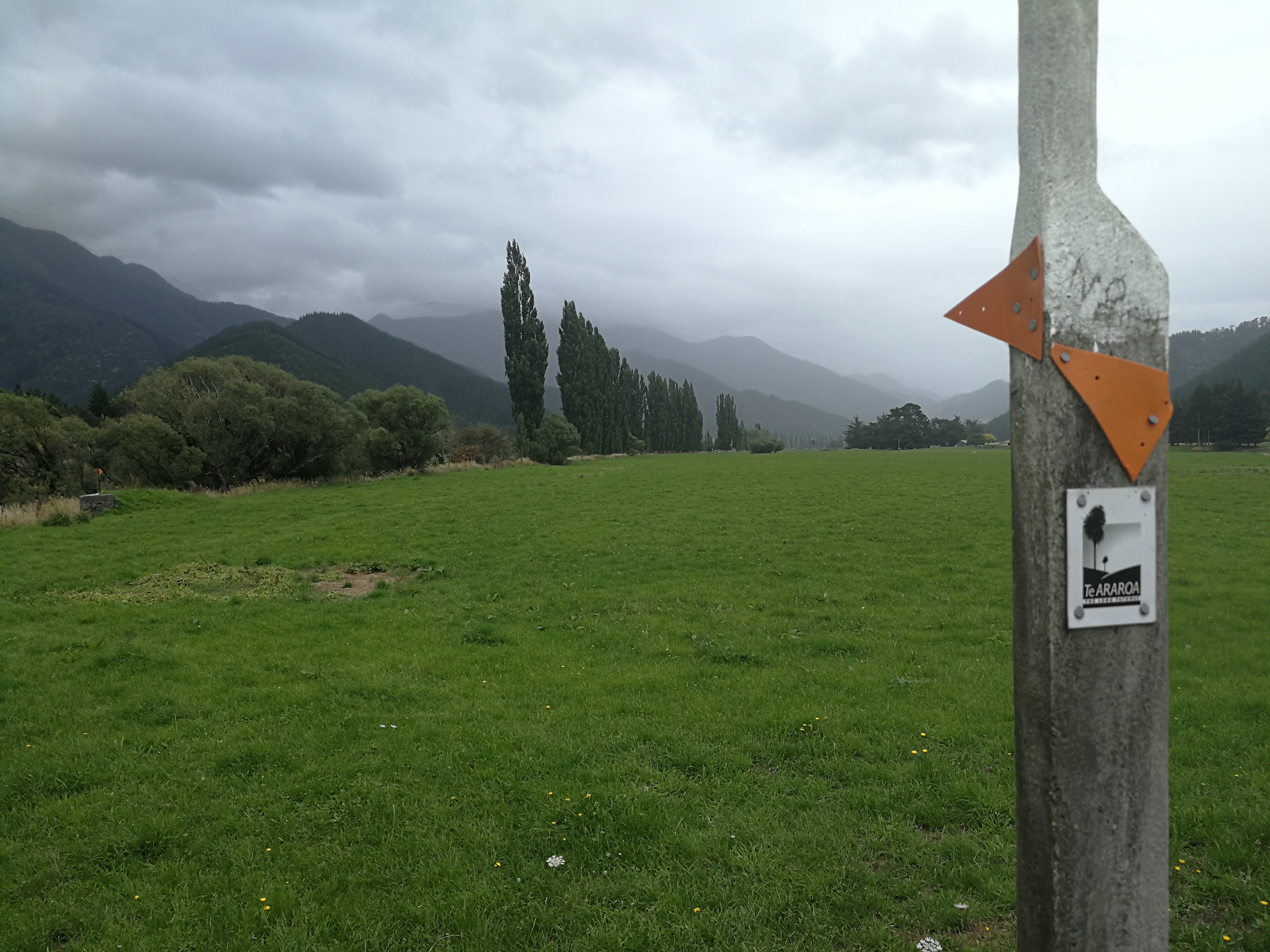
Near where the trail came off the gravel road and onto farm fields it started drizzling. I carried on for a while else I would boil, but as the rain grew more persistent I donned my waterproofs. I was now following the orange Department of Conversation (DOC) triangles.
A field with an awful lot of cows in lay ahead. I hadn’t met New Zealand cows before and haven’t always got on well with the beasts when walking. So, like the courageous adventurer that I am, I sat down for a snack break and let the two guys behind me overtake and go first. When they didn’t get trampled, I followed after. The cows barely blinked at me.
The fields alternated between meadows and turnips, and the meadows contained the greatest number of butterflies I’ve seen. White butterflies would erupt up like clouds as I disturbed the grass. My feet got soaked quickly in the wet grass, but the rest of me was dry.
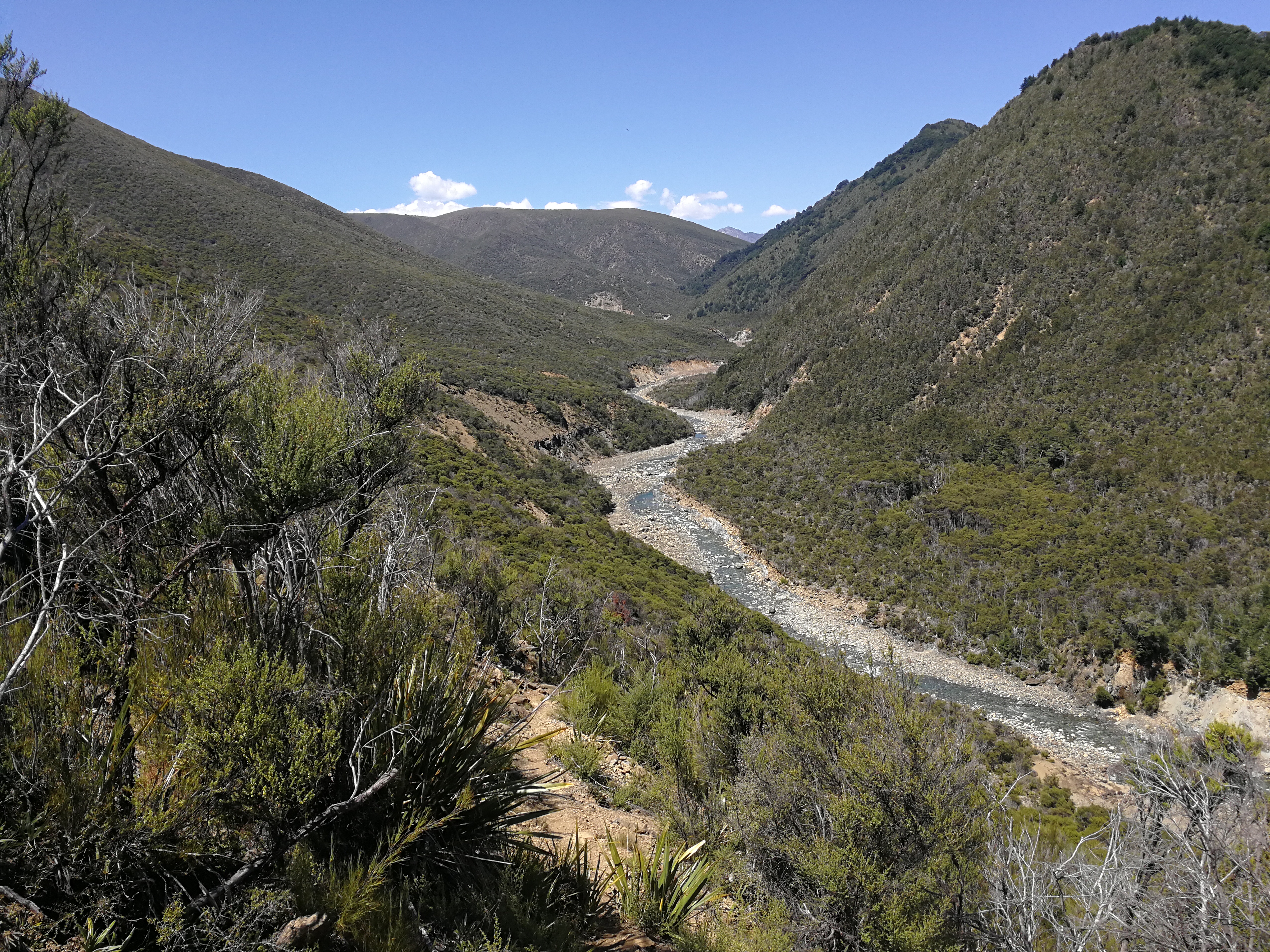
After some more undulating fields the trail entered a beautiful forest for a short loop track to Pelorus River. The bridge across said max 10 people but at the amount it was swaying with just me I would not want to be on there with 10! The campsite was across another bridge, and I joined the 3 hikers, and another, in the café, meeting Jay, Arne and Stine from Germany, and Chris from the US.
We swapped stories of our progress so far, and had delicious apple strudel and coffee. I went to check in to the campsite and retrieve my resupply box, and had a momentary panic when the guy couldn’t find my box (I’d have to hitch to Nelson…) but I found it in the office. Jay also had a box waiting, so we opened them feeling like Christmas. The site owner also showed us a room where we could all sleep on the floor, preferable over camping in the heavy rain and the site is liable to flooding. We were very happy (non) campers.
Stine went to Richmond, and Jasper arrived, meaning that with the girls coming later we’d be a cosy 6 on the floor. A while later the girls walked in, very soggy as the rain had intensified in the last couple of hours and were very happy to hear we didn’t have to camp.
Jasper and Arne hitched to Havelock for cigarettes, and came soon back with beers for all. The campsite had a decent cooking shelter/room so we went down for dinner, beer and played some cards before settling down in our shed.
Day 8: Pelorus Bridge to Captains Creek Hut
22km, +400m, -300m, 8 hours
The rain continued all night, and we were very grateful for our shelter, though I didn’t have the best night’s sleep. The campers were evacuated during the night as the river had got dangerously high, but didn’t reach the cook shelter or tents in the end. Apparently when they built it they never thought it would flood, but it has twice.
The morning was on an undulating tarmac-gravel road. The weather couldn’t make up its mind and alternated between heavy rain and sun, and often both at the same time, which meant I boiled in my waterproofs. The road led up the valley of the Pelorus River past soggy sheep and llamas, with bigger hills looming into view.
My bag had been really bothering me, and I wondered why I needed to take so many more breaks than the others. I felt the straps on top of my shoulders and the right one was loose. Pulling it tight was slightly miraculous – my backpack was still really heavy with 9 days of food but no longer felt like it was going to rip off my shoulder.
There were a few swingbridges later to cross some branches of the river which I was grateful for as it was a nasty raging brown. Still wasn’t a fan of the swinging though.
Rain from the hills was pouring onto the road making, at times, some mid shin deep fast flows across the road. Wet feet would be a theme from now on. I stopped for lunch at the end of the road, missing the benches on the Queen Charlotte Track already. My feet were sore from the road and sandflies quickly found me. Ali and Liv joined shortly after, but I didn’t hang around once I’d finished eating.
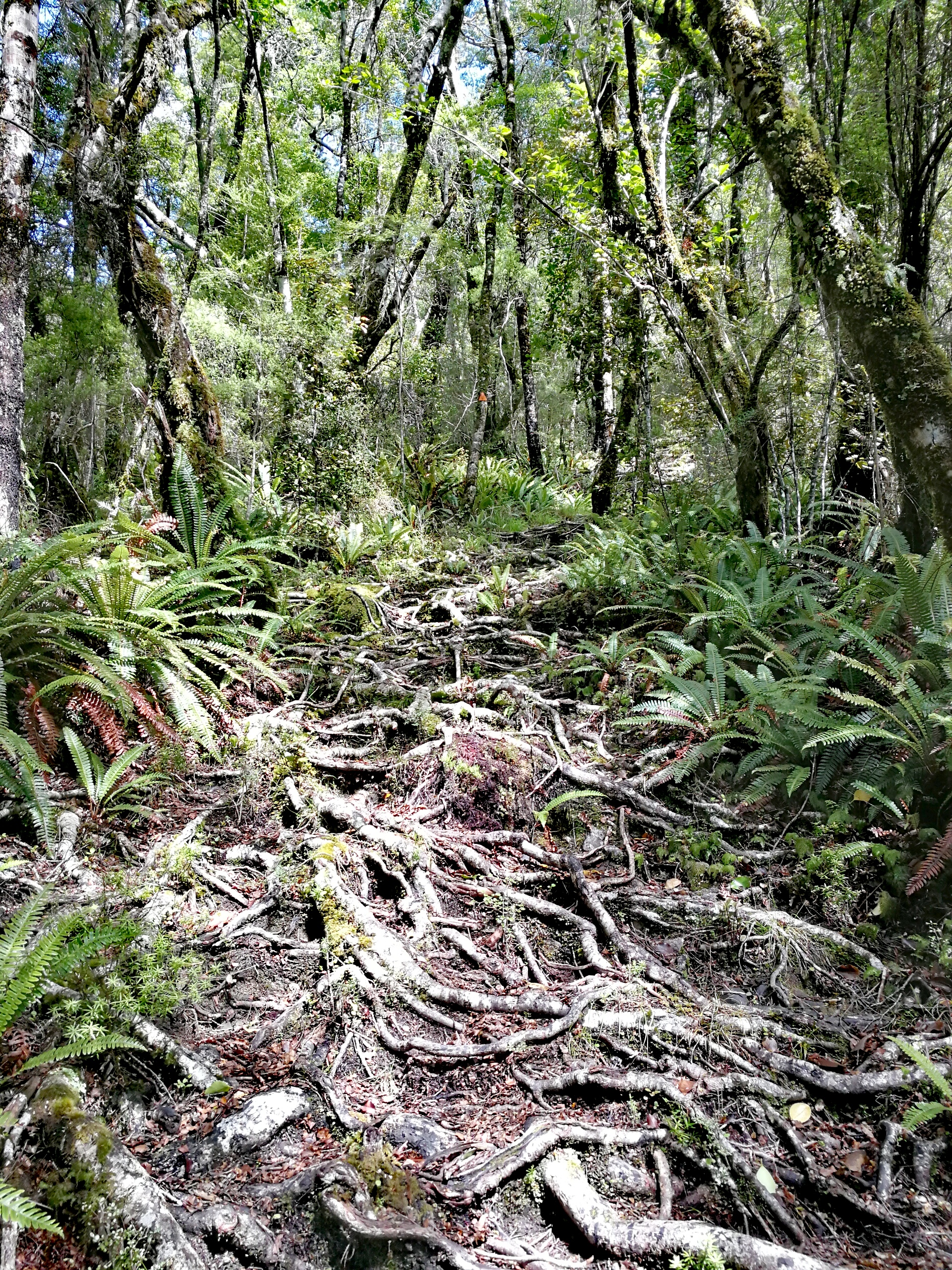
I started down the first proper track in the forest of the Richmond Ranges, which was a slight baptism of fire. Long gone were the wide, well-graded footpaths. Progress was much slower, along ‘paths’ wide enough for 1 foot at time, criss crossed with slippery tree roots, thick mud, steep drop offs and sidlings, requiring concentration for every step. This might take some time.
A while later I heard a rushing sound getting louder. Turning the corner I saw an orange triangle the other side of a small waterfall over big rocks, which was only a few metres from the main torrent of river. Er… I looked up the hill to see if there was an easier way round, but the water went into a canyon. I looked at the water for some time, sticking my poles in trying to gauge the depth. The only thing that gave me confidence was that 5 people had left the campsite before me and they hadn’t turned back, so it must be possible. Unless I’d missed their bodies floating down the Pelorus.
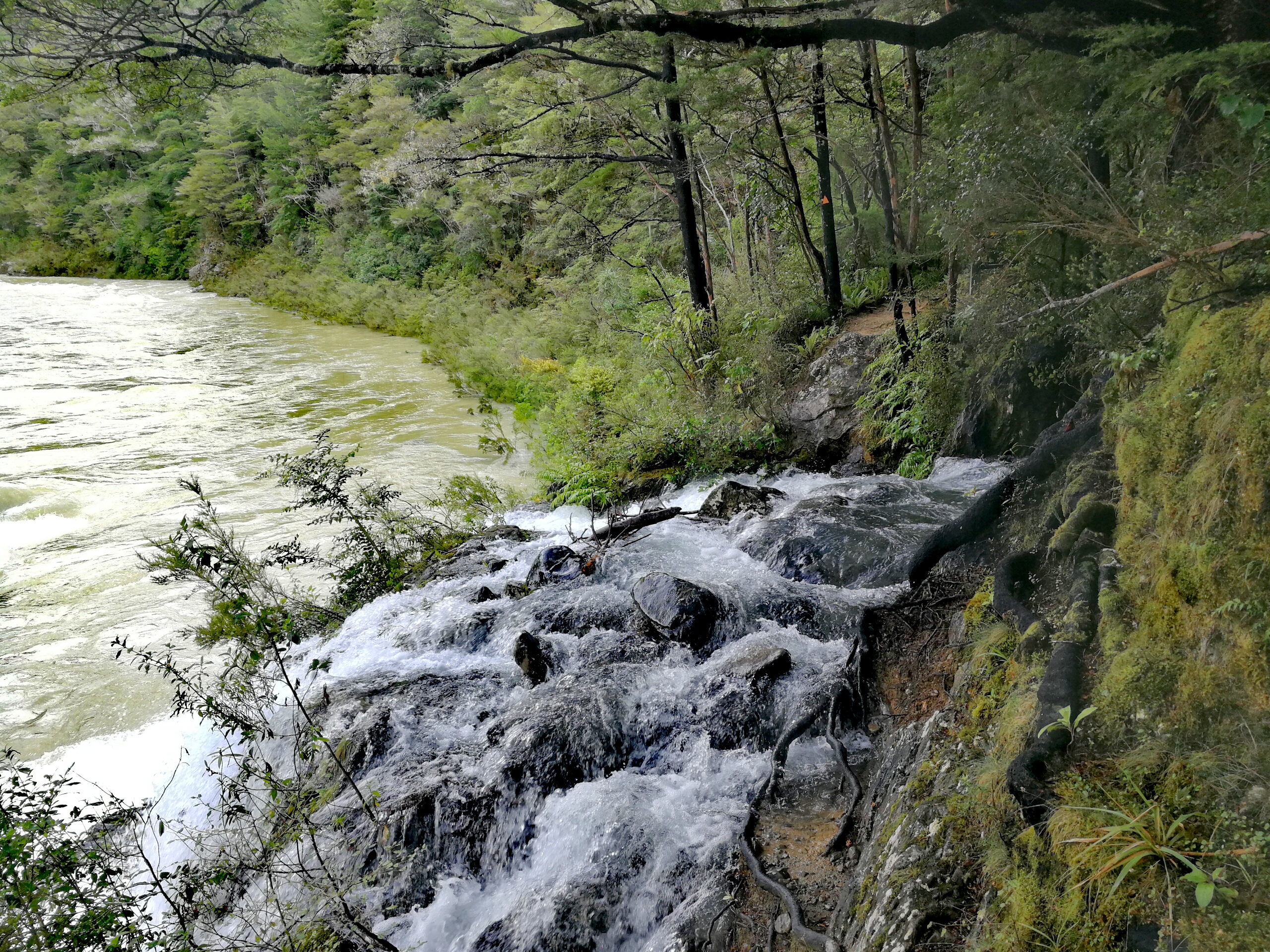
I put my right foot in, up to my knee, and immediately felt the force of the water. My poles were useless unless the water was shallow as they were too light and got pushed around. Slowly, I took a step forward, careful not to slip on unseen rocks, and this time it came up to mid thigh. A bulging rock the other side was one more step out of reach, and I took another step trying not to think of the consequences of falling. I leant forward and could touch the rock and lift my feet from the hole to shallower water, and then up the bank.
My heartrate was racing and I dumped my bag down, had a drink and then some chocolate to try and calm myself down. I waited for the girls to come to show them where to step and they made their way gradually across.
The going was slow and tough, and very humid in the jungle-like forest as the track undulated up and down the hill side. I stopped for a break and a robin immediately flew down to a log next to me. New Zealand robins are pretty much like European ones, except grey and white instead of brown and red, and much bolder. It flitted between the trees nearby and followed me for a while when I carried on.
As I grew more tired I kept checking the app (Guthook) to see how far away the hut was, and I started seeing what could be corners of huts but turned out to be trees. Eventually I heard voices and descended to Captains Creek Hut. There was a tent up so I was worried the hut was already full, but there were 4 beds left as only Arne and Georgia were there. I happily flopped onto the bed as we recounted the dodgy river crossing.
There were lots of sandflies about so I went to the river to collect water and then filtered it whilst walking around the site to try and keep ahead of them. After the girls arrived, happy to hear there were beds left, Georgia chopped some wood up and Arne lit the wood burner in the hut. We weren’t cold but it was nice and cosy and helped to dry our socks (slightly).
Day 9: Captains Creek Hut to Browning Hut
21km, +1200m -700m, 9.5 hours
Our alarms went off at 6am, and whilst I hadn’t had the best night’s sleep, the DOC hut mattresses were pretty comfortable.
A series of swing bridges criss-crossed the Pelorus until the track veered away and I started the long climb up to Rocks Hut. I climbed for two and a half hours. It was all in the forest so I was thankful for the dappled shade, and it was very pretty. A robin followed me again for a while. The gradient varied so I could recover on the less steep sections, and slowly I plodded and sweated my way up.
Rocks Hut was a palace with 16 beds and a flushing toilet, and I arrived just as Georgia was carrying on. I tucked in to lunch and the girls arrived soon after.
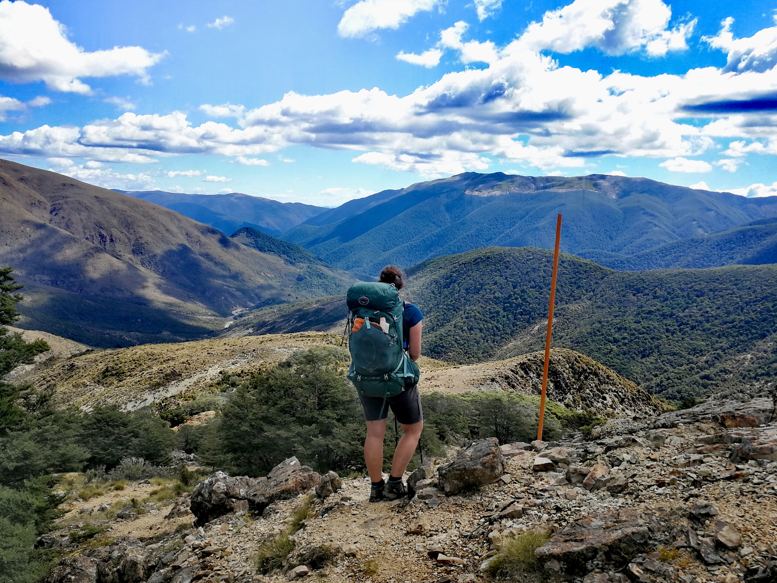
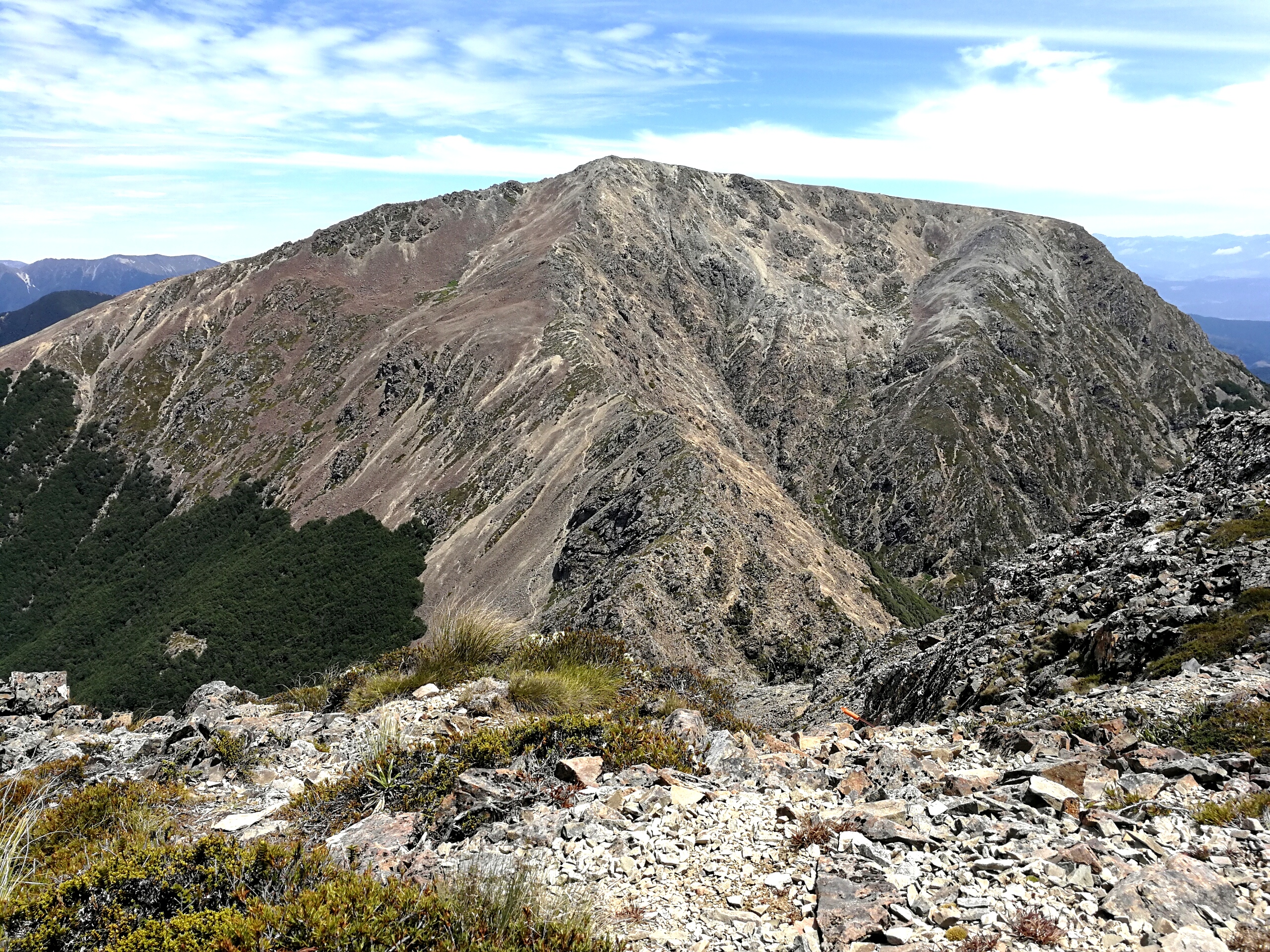
Unfortunately it was another two and a half hours climb after the hut, albeit less steeply. I thought that as I was faster than the DOC suggested time to Rocks I would be for this section two, so it was frustrating when this turned out not to be the case. Near the top it was very slow going as there was a lot of big tree fall. Most had been chopped through but some I had to clamber over, which isn’t terribly easy with a big pack to unbalance you. From one I put my left foot down and it fell through the earth. There was so much dead wood that a lot of the ground was actually hollow, which meant my poles gained another use. The tree fall did mean that I got my first views of the surrounding mountains.
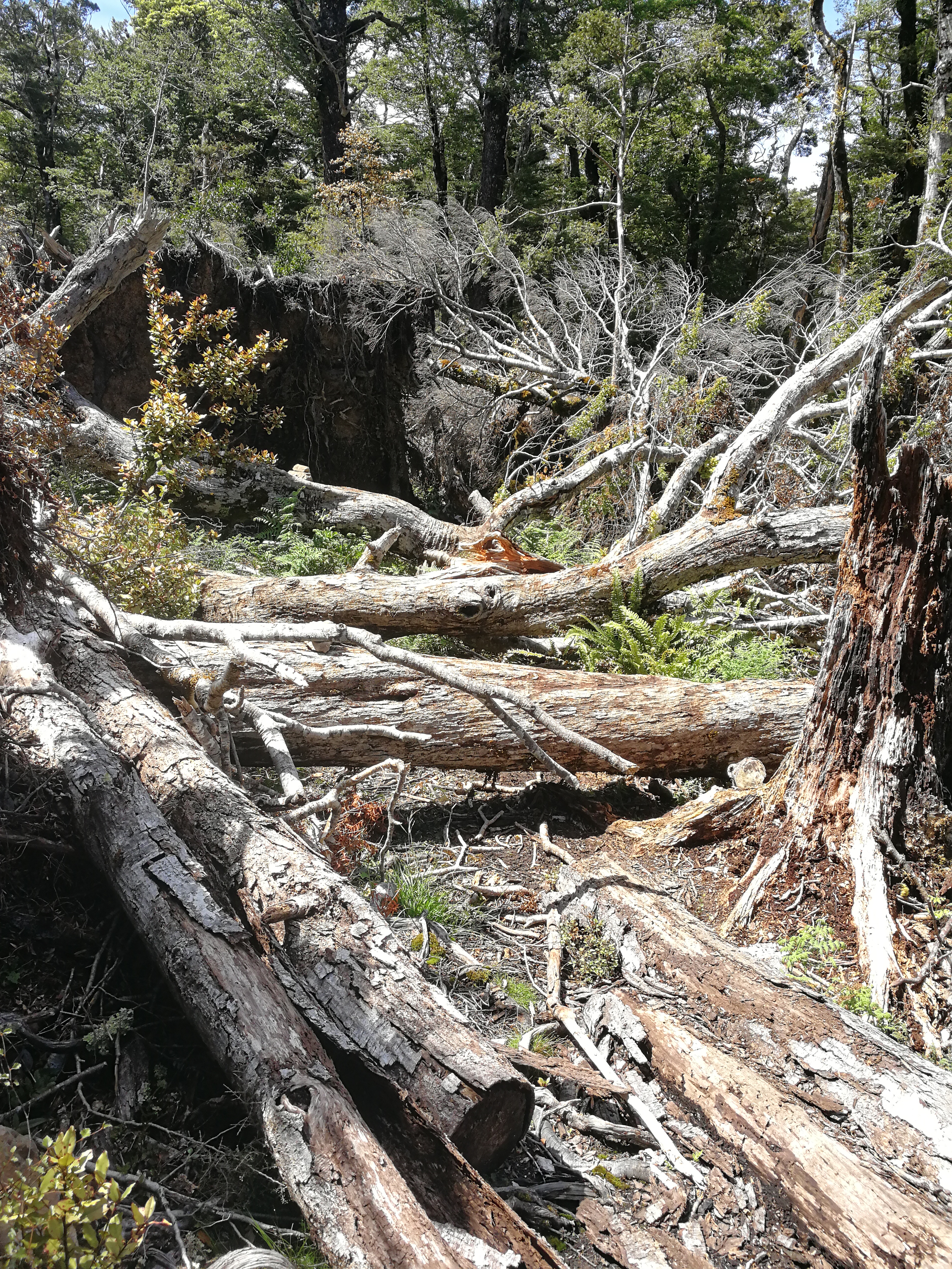
It was then a steep two hour descent down the other side. This was to be a theme – up and over every peak, and New Zealand haven’t really heard of switchbacks. It was back in the forest though and I just took it steady. The last section got very steep nd I had to sit on my bum a few times to scooch down the hill.
There was a stream crossing just before the hut in typical Kiwi humour. Jay and Georgia were already there and the girls came a while later, finding the downhill pretty tough. The stream did mean we could have a bit of a wash, and it wasn’t far to go for water. The bench was covered with all our socks, shoes and shirts drying in the sun.
Browning Hut was near a trail junction with a coupe of hours walk from a car park from Nelson, so later in the evening 2 pairs of locals came up after work (it was Friday), probably surprised to find the hut almost full and everyone asleep by 8.30. This is one of the ways the TA is starting to have an impact – numbers of TA hikers are growing by hundreds each year, and many more do just the south island like me. The huts in some of the stretches are only 6 beds, built for hunters, meaning they’re often full, and there’s not always space for tents outside. We wondered if they’d introduce a permit system in a few years like for the PCT in America where there’s a cap on the number that can start each day. But with the unpredictable weather in these mountains I don’t know how practical it would be. The infrastructure will definitely need improving to cope, and whilst there is a customary voluntary donation to the DOC by TA hikers, I don’t think a fee would be unreasonable to help finance this.
Day 10: Browning Hut to Slaty Hut
14km, +1450m -550m, 9.5 hours
As alarms went off at 6am we cooked outside to let the father and son sleep in. It was just over an hour of more gradual descent down to Hackett Hut. There was a high and low river route option and as I couldn’t see how I would get down to the river without falling head over heels, I took the flood track, thinking it would just follow near the river but instead it sent me on a steep climb for 10 minutes before descending just as steeply the other side.
I overtook Jay at a small river crossing who was taking his boots off to cross. He knew that we had a lot of bigger crossings coming up where he’d get wet boots but wanted a little luxury in the meantime.
From Hackett Hut the TA moved from a ‘tramping track’ to a ‘route’ which the DOC characterises as unformed and rough. What had we been walking on so far? After a swingbridge I came to my first proper river crossing. I could see a big orange triangle the other side of the water. The river today was much nicer than a couple of days ago, and whilst still quite fast it was crystal clear. I picked my way across with the water coming up to my knees. I looked up the hill past the orange triangle and saw a small track start steeply, so I pressed on. The forest got very dense very quickly but there were still footprints so I carried on, wondering if this was what DOC meant by ‘rough and unformed’. It’d take me weeks to get through…
After a while the small trail I’d been following petered out. Hmm. I hadn’t seen any orange triangles for a while, but maybe the routes weren’t signposted? No, I think they were. I looked all around but couldn’t see any kind of path, not even where I had come from. I suddenly felt very alone. I took my bag off and sat down, had a drink of water and thought about what to do. I looked at the GPS and the path was meant to follow the river for this section, not go up over a hill, but the resolution wasn’t perfect so maybe it was so steep it looked close to the river on a map? I had a bite of a chocolate bar. I could stay here and wait for the others to come, if this was the right path, and we could find it together. But it might be the wrong way and I’d be waiting forever. I could go back down the way I came and see if I missed any signs. Worst case I would lose half an hour if it turned out this was the right way and I had to climb it again.
I put my bag back on and headed down, which involved a lot of holding on to trees as I couldn’t see where I’d come from so just went down in the direction of the river. I came across a tree I remembered climbing over, and found the footprints again. Back at the river, I scanned around for any more orange triangles. There! Upstream there was a small one, not immediately visible from when you finished the first crossing. I swore quite loudly. I had gone the wrong way. I was also immediately relieved that it hadn’t been the path, otherwise it would have been ridiculously slow going. I considered waiting for the others to come to warn them but didn’t know if they’d already overtaken me, so carried on up the rocky river bed and some more river crossings. From then on I made sure I could always see the next orange triangle before leaving the previous one.
The trail left the river bed and began a steep, long climb in the forest for a few hours. Higher up the shade got sparser and it got hotter and hotter. I staggered out of the treeline to Starveall Hut where I met Min, a Korean buddhist-in-training, who I felt very grubby compared to her serene white robes. I lay down in the shade for a bit and refilled my water bottles from the hut, before appreciating the views – I could see the sea. Jay arrived, and the girls soon after, and we realised we’d all made the same wrong turn back at the river. Only now we’d added more footprints to the non-path.
I turned my phone off airplane mode to check for signal and managed to get the weather forecast which looked promisingly dry for future river crossings and exposed sections.
After lunch the climb continued but felt less of a slog with the views, refreshed after a break and there was quite a steady wind to cool down despite being in the sun. The views were incredible, although I had to block them out at times when it was a bit of a scramble section where it wouldn’t do well to slip.
Just below the top I met my first TA NOBO (someone walking the TA northbound, compared to all of us SOBOs) who said I was in for a treat with the views the other side. She wasn’t lying, and I actually cried a little when I got to the top. Those who know me know this isn’t normal behaviour, but what can I say. I was tired, it was beautiful.

After a short walk along the top the track descended into dry short trees, rather than the thick jungle-like beech forests of before. A final climb rose just above the treeline to come to Slaty Hut.
The hut was full again, with 2 on the floor, and Min elected to sleep outside under a blanket as it was going to be a nice night, as did a local hiker.
Day 11: Slaty Hut to Mt Rintoul Hut
15km, +1150m -1300m, 9 hours
I didn’t wolf my porridge down with my usual gusto this morning, but set off feeling fine nonetheless. It was a gentle climb through the scrub then across a screen slope before reaching a gorgeous ridge walk. I caught Jay up who was still taking photographs, and he took one for me. We were above the clouds in the valleys and the sun was shining, I couldn’t stop grinning.
After an undulating stretch on the ridge the path descended roughly requiring some navigation across rock fields on trees, before climbing up to Old Man mountain. It was getting pretty hot and I was feeling a bit queasy, climbing very slowly, but making forward progress all the same. Min, Jay and Ali P were at the top and we were excited to find a water barrel which we could filter and refill our bottles from.
From Old Man the path undulated steeply up and down, in and out of the scrub trees, before the first of the big climbs of today, to Little Rintoul. I still wasn’t feeling good and was having pretty negative thoughts about how incapable I was and how I would never make it. I took a break in the shade as the trail was about to go above the treeline, and Ali and Liv caught me up so I carried slowly on with them, which helped. Liv was climbing slowly too, with Ali scampering up and stopping to check we were still coming every now and then.
At the top there was a rather narrow ledge traverse around the pinnacle which needed a lot of concentration, and was somewhat unnerving considering how high I was, but I got through it easy enough. I was hoping to find some shade of an overhanging rock but had no such luck, so stopped for lunch just over the other side where there was a bit of a breeze at least.
I wasn’t feeling hungry at all but knew I should be, so forced down a nutella wrap. I could see tiny figures on the next mountain, Mount Rintoul, which involved a steep descent and climb in between. I left the girls eating and started on the descent, which was pretty terrifying. I’d heard stories but couldn’t remember if it was this descent or the next one; I hoped this one as I couldn’t imagine much worse. It was a very steep loose scree slope with a long cliff not too far away from the side. Semi-controlled falling was a necessity and I was glad there wasn’t anyone nearby as a lot of rocks would continue falling as I skidded down. My knees weren’t too happy about it. Near the end there was a rock traverse and drop which required jump switching my foot that was on a rock step – a move I’d done on the climbing wall but not with a ~17kg pack. I made it to the bottom largely unscathed and found a tiny corner of shade to sit down in.
The beginning of the scree slope ascent up Mount Rintoul was only marginally less terrifying, as I had to keep my weight forward and couldn’t really have a break for fear of sliding/falling backwards. When I moved from the scree to rock, I sat down for a break, feeling nauseas still, but admiring the views.
Cloud suddenly covered the top, which I wasn’t too upset about as it wasn’t too thick to hinder navigation, and meant a break from the sun. Liv gave me one of her glucose sweets, and together we slowly reached the top. Whether it was the company, the sugar or the main work of the day done, I felt better and my mood greatly improved. Maybe I’d worked up that descent so much in my head that I made myself ill? I don’t normally feel physically sick from fear, but then I don’t normally cry at mountains. C’est la vie.
From the top it was a cautious drop down and up again around a spikey rocky ridge, and then we began the real descent. This turned out to be great fun as we could basically ski down the thick scree slope. We had a break at the treeline and I removed a small quarry from my shoes.
The descent continued steeply through the trees before arriving at a very full Mt Rintoul Hut, with 5 tents outside already. It was an odd place to call home for a night – a small clearing on the side of a mountain, up in the clouds, with a whopping 16 people. It was lovely and very international, we had kiwis, Swedish, Swiss, Canadian, German, Dutch, American and British. Tim led a yoga session around the tents which was filled with laughter as everyone was tight in different places. We ate dinner with a Swedish trio of girls – Anna, AK and Linda, in fits of giggles. Camp Rintoul was asleep by 9pm.
Day 12: Mt Rintoul Hut to Mid Waiora Hut
15km, +600m -1500m, 7.5 hours
I still wasn’t hungry but forced some porridge down. It began drizzling as I was packing up but not enough to warrant putting waterproofs on. The initial climb was in trees anyway, until it opened out onto Purple Top, named, I can only presume, for the colour of the rocks. At first the air was so still I could hear Swedish from the couple, Sofia and Pontus, across the ridge, but then a cool strong wind gustsd through, swirling up the clouds as well.
I didn’t hang around on the top and picked my way down across the small boulder field crossing on the other side then back into the forest. I felt pretty nauseous and actually tried to throw up a few times thinking it might make me feel better but I couldn’t. It was quite a long descent and I started singing to distract myself.
At Tarn Hut I had a half hour lie down on one of the bunks. I made myself eat a wrap but was near gagging by the end – by this point eating and drinking were making me feel sick, and I was concerned I might have picked up some kind of water bug, but it would be strange as I’ve been filtering/not filtering the same water as everyone else and no one else was ill.
I set off up the climb, Sofia and Pontus as we took breaks at different times. Then began another big downhill. The trail would emerge into a clearing every now and then, most of the time the views were obscured by clouds but as it descended they cleared up. I was still sweating lots descending. I switched tactics to copy the Swedish and let my legs run/fall down the hill, supported by poles, rather than my usual shuffling. I don’t know if my knees preferred it but it did get me down quicker.
Eventually I came to Mid Waiora Hut, and I was ushered in to shut the door quickly as there were lots of sandflies and bees around. Bees may be endangered in Europe but in New Zealand they’re nearing pests, and seemed to like me intensely. I’ve never seen so many. As the hut was full of the Swedish girls, Ali and Liv, and Min, I was on the floor. It was nice, and a bit unusual, to have an all-women hut.
I’d mentioned to Ali (who happens to be a doctor) earlier I’d not been feeling good, and when I sat down she gave me a rehydration sachet which smelled delicious but tasted horrible.
We went for a dip in the river which was lovely to be cleaner again but freezing so it was more of a splash than a paddle. The water was so blue and clear. But also surrounded by sandflies and wasps which built their nests in the riverbed rocks.
Min kindly said I could lie on her bed until night as she liked to be outside, but it was near the ceiling with bees and I didn’t notice when one came down and landed on me – I shifted reading position and leant on it causing it to sting my arm. With a yelp I clambered back down.
We realised that there were holes in the hut roof windows with a bees nest and a wasp nest in the roof, and both were getting in to the hut. We renamed the hut Bee Hut. The wasps weren’t much bother but the bees flew down and buzzed around us. Linda also got stung by one. Equipped with a stick and bits of newspaper, Min gradually plugged the holes, whilst also tag-teaming captured bees and wasps to Anna who would run them outside.
It seemed to do the trick, and we settled down to sleep, only slightly traumatised by buzzing.
Day 13: Mid Waiora Hut to Hunters Hut
18km, +1300m -900m, 10.75 hours
None of us were too sad to leave Bee Hut behind, and I set off with Ali and Liv through a beautiful undulating woodland track. The woods are also full of wasps and bees, and there are a lot of wasps around beech trees with black mould. Largely they fly out of your way, but one landed on my ankle and with my next step I pushed it against the tongue of my shoe, causing it to sting me. I yelped again but I’d already taken antihistamine for the bee sting so there wasn’t much to do.
The river crossings came later than expected but in the end we counted 8 full crossings. I quite enjoyed them – it was hot and the water was refreshing. We’d been lucky with the weather though, I didn’t feel in danger on the crossings but could still feel the power of the water (it’d been almost a week since significant rain) and wouldn’t want to attempt them much stronger or higher than they were. We leapfrogged the Swedish girls from time to time and gradually climbed higher up the valley.
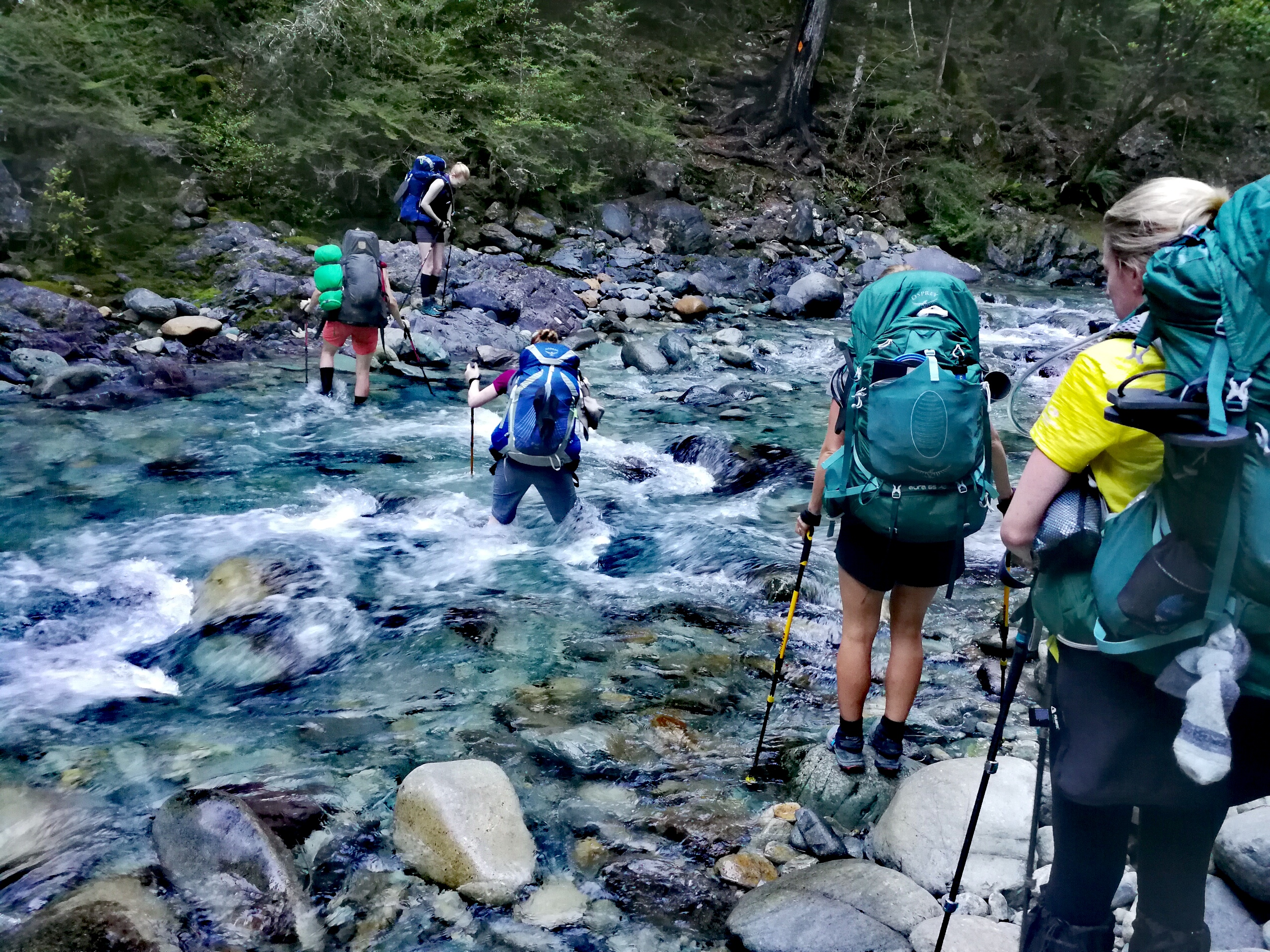
We’d seen warnings of a dangerous narrow sidling section between Mid and Top Waiora Huts with New Zealand stinging nettles in the places you might want to grab on to. NZ stinging nettles are like the European variety, but can leave you swollen and numb for days. We kept our eyes peeled but didn’t see any, and the sidling was no worse than some other sections in the Richmonds.
After the river crossings the climb grew steeper until suddenly it emerged out of the lush, green forests into an arid, rocky valley. A very steep climb/scramble led to Top Waiora Hut. Annoyingly there was no rain water barrel at the hut – the supply was the river back down the rather long climb. There were streams to cross coming up though so we could filter from those. I’d been feeling alright up to the hut but soon felt a lot worse. Ali gave me another dioralyte. I managed to slowly eat two chocolate wraps, and we headed up the long ascent.
There was very little shelter from the sun and it was blazing hot. The path alternated between picking your way across large, red, rough rocks and tussocks. I tried to sip water as often as possible but it made me feel really sick. It was slow going. But, only I could get myself out of this mountain range. We were in the middle of nowhere. Left foot, right foot.
Ali and Liv had gone ahead but would look back to check I was still moving. Left foot, right foot. I could see the girls on the ridge and they might as well have been on the moon for how far away they seemed. But, slowly and painfully I got there. Liv gave me another glucose sweet, I forced some more water down, and with the relaxation in gradient along the ridge I felt a lot better. The views were also stunning.
The climb eased to a long crossing of a scree slope, and then it was a final push to the top of the Mt Ellis saddle. Min was there enjoying the views and we sat for a while taking it all in.
On the way down we realised we could see tonight’s hut along the valley. It looked an awful long way away. It felt an awful long way away, but the going down was better than the going up had been, and we chatted through the km.
There was one more river crossing of the day, then a steep, horrible 100m climb to the hut. The sign said 15mins which Liv and I laughed at, but Ali thought she could do it so set off almost at a run – insane amount of energy – and made it.
I arrived some time later, almost delirious. I lay down on a bed on the top of row exhausted. The Swedish girls arrived a while later and when I couldn’t make a decision on which bed was free (I’d exploded my things over two), Liv got Ali to come check on me. She gave me another dioralyte then carried a mattress outside into the shade where there was now a breeze and got me to lay down, thinking we needed to get my temperature down and that I might have some level of sun stroke/heat exhaustion. I slowly sipped at my bottle of water and although I now had goosebumps from the wind my forehead was still burning. A couple of hours after arriving at the hut I felt a lot more with it, and had an attempt at dinner.
The hut had an amazing view back up the valley to Mt Ellis and I still couldn’t believe I’d walked all that way. I chatted with Min whilst prodding my nutella jar and found out that she used to be a contemporary dancer, and had even been to Oxford on tour, and was now doing her training at different monasteries. There was a lot of sitting in contemplation though, so she was walking for a few week’s break.
I managed another bottle of water before bed. The wind howled in the night and when I went out to the loo I realised my shirt I’d draped over the line to dry was no longer there. I scanned around with my head torch and gratefully retrieved it from the ledge below, fearful that it had blown away and I’d only have 1 t-shirt. I turned my torch off and looked up – the stars were stunning. Light pollution is pretty low in New Zealand generally, and in the middle of the mountains I could see the milky-way and thousands of stars.
Day 14: Hunters Hut to Red Hills Hut
19km, +1200m -1000m, 9.5 hours
Later, Ali told me she was quite surprised I got up ready to go in the morning, thinking I might need to spend a day recovering I’m the hut. The thought had occurred to me, but I figured that as I wasn’t eating or drinking much I’d only get weaker as the forecast was more and more sun. Plus, I felt a million times better than yesterday afternoon. I had a snack bar for breakfast and managed half a litre of water, then left by 7am, keen to cover as much ground as possible in the shade and before it got too hot.
Also, I had a Plan. I would sip water at every opportunity, and dunk my hat in every stream I crossed (there were a lot today) to keep myself cool. Today was a lot less strenuous than yesterday, going up and down a few saddles and up a long valley, rather than a continuous 1000m climb. Still, it wasn’t exactly flat.
I managed the first two saddles before the sun got over the peak, and I was committed to the hat plan – sometimes I was a bit over zealous with scooping the water and as a result was completely drenched. Well, it couldn’t be a bad thing.
I caught up to the German couple, Steffi and Holgate, on a particularly nasty descent across a scree slope above a cliff. So far scree traverses had been okay as the tread has been sufficiently compacted to be stable, but this felt like one foot wrong would send you sliding down and over the edge. I was very glad I had 2 poles for support.
After a bigger river crossing it was then a gentle longer climb to the highest point of today. I was still feeling good and still drinking regularly. There were gorgeous views from the top and then it was an undulating descent to Porters Creek Hut. I was happily splashing through a muddy section when my left foot sank up to my knee. I pulled myself out and burst out laughing. Thankfully there was another stream to clean myself off before the hut.
The hut was nice and cool and I refilled my bottles and ate another bar as the others trickled in. I’d expected them to catch me earlier so was happy with progress so far. I was feeling fine but expected to flag later on in the sun.
There was another dodgy scree traverse over a cliff after the hut, and then the path went along a large dry riverbed for a while before up another saddle. At one point a robin flew down right in front of me which I almost trod on. I sat in the shade at the top to cool down and the others passed through.
The remainder of the day was along an undulating side of a long valley, with scrub not big enough to provide consistent shade. At one point the path came out to meet a river, the other side of which was a cliff face with an orange pole on top. Really? Eventually I saw a triangle lower down, but there was a lot of huffing and puffing to clamber up.
After a wider river crossing the track climbed very steeply in sections in the full sun, and I trailed behind Ali and Liv. It was slow going and I felt weak and frustrated that I couldn’t eat much, but overall much better than yesterday. The gradient gradually eased and we reached the long grassy lead up to Red Hills Hut.
The hut was lovely new and clean, and importantly with mesh over the windows so we could get fresh air without letting in sandflies or bees, and Liv volunteered for the floor this time. It was another all-women hut (Sofia and Pontus were camping) and everyone was excited to be close to civilisation, salivating at what they were going to eat tomorrow.
Day 15: Red Hills Hut to St Arnaud
8km, -300m, 2 hours
From my top bunk I had a beautiful view our of the window down the valley where the sun was just reaching the peak of the far mountain.
I didn’t feel up to porridge again but a snack bar went down fine, and I drunk another bottle of water over the next half hour. Liv’s knee wasn’t very good so we took the shorter route down, on a well graded gravel track, whilst the rest went the full route including a fair bit more of climbing. Our egos took a bit of a hit, but it was the sensible decision; today was going to be another scorcher.
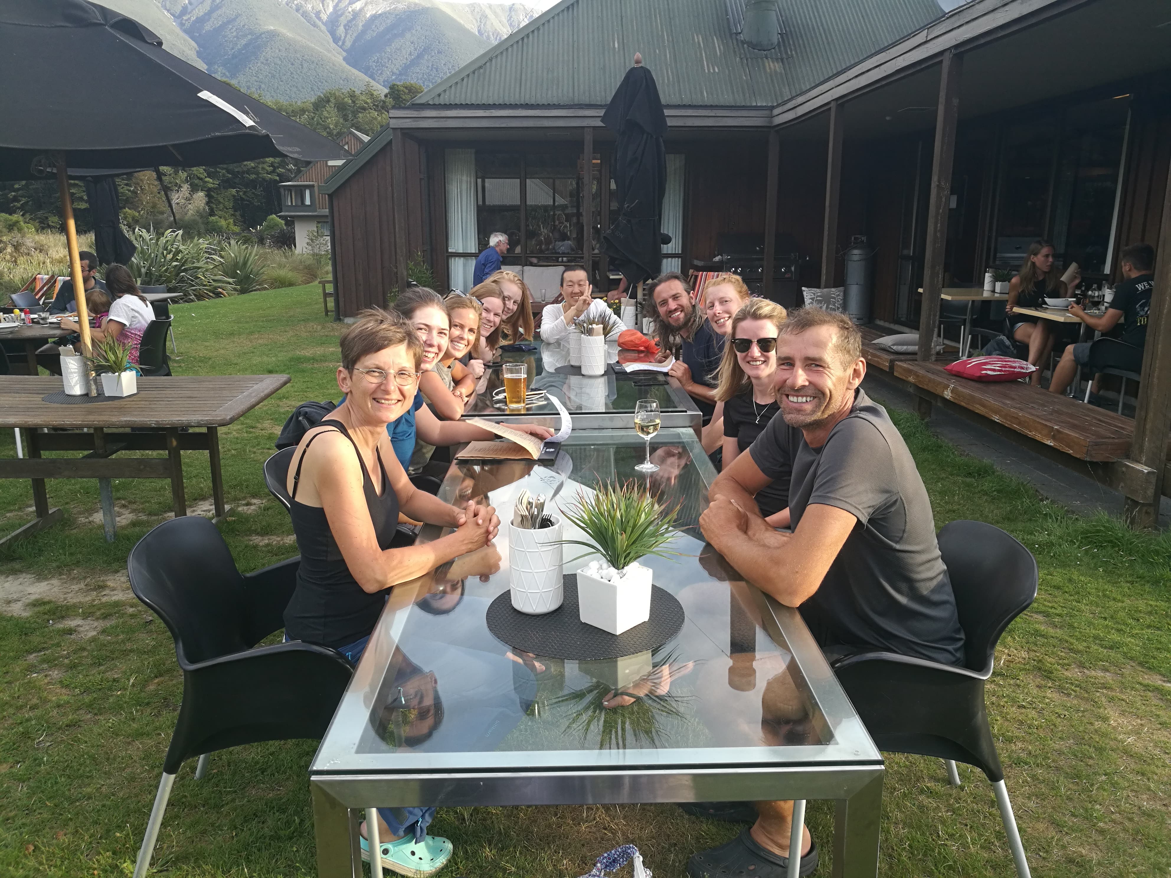
Once down we thought we might be waiting quite a while for a hitch as the road (a fairly main one on the south island) had about 1 car pass every 5 minutes. But soon enough we got a ride to St Arnaud and I went to the Travers Sabine Lodge to see if they had a room. They did so I booked for 2 nights, then joined Liv at the cafe for a strawberry milkshake and French toast. I didn’t quite finish it but felt full rather than sick, and it was the most I’d eaten in one sitting for a few days so thought it was good progress.
We caught up on the Internet for a while before concluding not a lot had happened in the world whilst we’d been in the mountains. And then contemplated how much time we would otherwise have spent glued to our phones during that time checking that not a lot happened.
We had a quick trip to the lake then checked in to our respective lodging. The Lodge was very homely for a backpackers and I had my first shower in 9 days. I had to wash my hair 3 times to get it feeling clean. Next: laundry. This didn’t leave me with much to wear in the meantime.
The Swedish arrived in the room next to me and we had a mini Christmas again opening our resupply parcels. The Lodge had a storage room with a lot of boxes from TA walkers – they’d had 40 in December and were going to be over 70 in January, clearly embracing the surge in travellers.
We hung out in various states of undress depending on how many spare clothes we had, but our washing dried in no time in the heat and the breeze.
The Germans arrived later, having walked from Porters Creek Hut, and in the evening we all went to the Alpine Lodge for amazing pizzas. It was nice eating proper food with the whole gang from Hunters Hut, and we toasted, on very nice wine, (in Swedish, German and English) to our survival of the Richmond Ranges.
Day 16: St Arnaud
Very lazy rest day. I had a full cooked breakfast at the cafe which went down very well, then went to the DOC centre to check conditions for the next section. There was no snow left so no avalanche concerns (there can be all year round on the Waiau pass). I bought a few supplies from the shop then went to lay on the sofa out of the sun, drinking sprite and eating crisps for most of the day. A big thunderstorm rolled through late afternoon which finally cooled things down for a bit.
brilliant write up! and look at all the challenges you have overcome already – crossing the waterfall/rivers/wrong turn/steep descents/bees/illness etc. chapeau!!!
Glad to hear you are feeling better 🙂
Are you still in St Arnaud? X
Thanks! Yes, setting off after lunch for a short day back into the mountains for a 6-7 day stretch 😊
A great read Kat.
It sounds the sort of thing I’d do !
Obviously I’d need to be on a massive salary as nobody would contemplate this sort of thing just for fun 😉
The pictures are brilliant.
Take care….
A challenging section that! You kept going well whilst not feeling so good, too.
Do you have to stay/camp at the huts, or can you pitch up anywhere you fancy on the trail?
Unless it’s private land you can ‘freedom camp’ anywhere with the usual LNT rules, huts are just easier with shelter, a water supply and toilet! In the Richmonds they’re pretty well spaced but I think I’ll be camping more later on.