
This section covers Lake Sumner Conservation Park and the top of Arthur’s Pass National Park.
Day 25: Boyle to Hope Kiwi Lodge
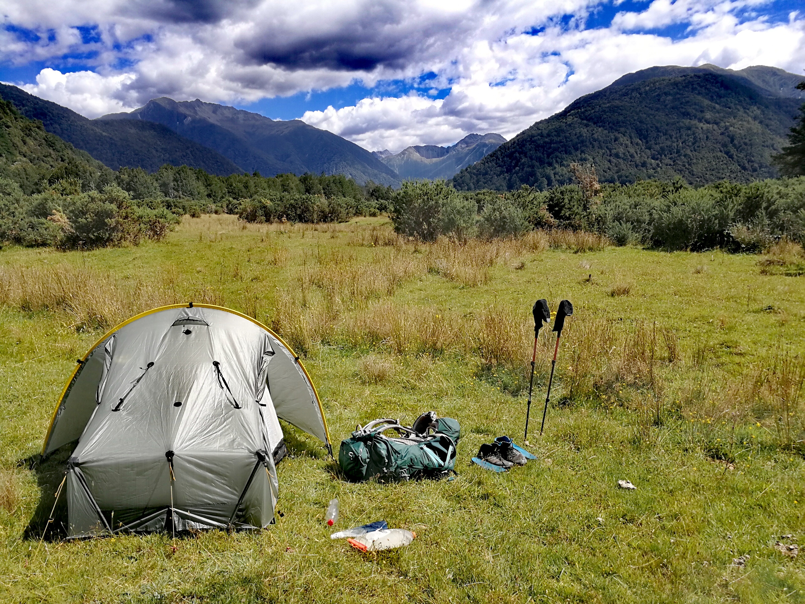
27km, +200m -200m, 7.5 hours
Ali and Liv had managed to source a taxi from the outdoor shop to take our party of 8 back to Boyle at 7am on Sunday, which for not a lot of $ each was preferable to an unknown amount of time waiting for a hitch, and today was going to be a long one as it was. We saw 3 other cars on the road in the 45 min drive. Refreshed from two lazy days in Hanmer, we were keen to be back on the trail.
I set off at 8am, following the Tui track adjacent to the road and getting wet feet almost immediately from the long grass. The trail crossed the road and soon came to the first big river crossing of the day. I walked upstream to have a look for an easier crossing but ended up going back to where it was marked. The others arrived by this time and we crossed it together, the water coming up to mid thigh.
I walked with Sofia and Pontus for a couple of hours, Pontus setting a strong pace. My bag felt super heavy again after resupplying in town. We walked across the river flats, sinking up to our knees in bog at one point, and crossing little streams. The second big river crossing was scarier than the first – it reached my upper thighs and the rocks at the bottom were large and slippery, I could feel that if I slipped the river would take me off. Probably should have looked a bit upstream. Safely across, we carried on.
The trail followed a fence for a while then rose up over scrubland, with an easy climb giving great views across the river plains and hills to the east. I stopped for a break and they carried on.

The trail then led into beech forest, with more trees fallen across the path the further I went in. A couple of people had come through from where we were heading today though so it had to be passable. I think we’d all been a bit traumatised after our escapades in the woods with the cyclone as now whenever a breeze went through the trees I would look up, wary of potential fallers.
I stopped for lunch at Hope Halfway hut, leaving just as the Swedish girls arrived, and glad to hear everyone had made the river crossings okay. The trail headed off into the forest for a while then emerged onto open cattle flats, with short spiky trees. Typically, the cows were scattered across the path but they moved out of the way as I approached.
The edge of the treeline had taken a heavy hit from the ex-cyclone Fehi last week as about half the front row had fallen down onto the flat. The path made for quick walking and I caught Sofia and Pontus up after a swingbridge. The northbounders had said that at one point it was better to go round in the meadow than through the trees as it was impossible to get through the forest so many trees were down. We thought about it but worried about losing the trail, so headed into the woods.
For a while it was fine with the odd tree down requiring scrambling over (for me, Sofia and Pontus could gainly stride over some with their longer legs). But then we saw why they’d said it was impossible. This section had got the brunt of Fehi, our section to Boyle had been more on the fringes. Later, reading the hut books, I shuddered to see some people had been walking this area when it hit. Massive trees had toppled over all across the path and we couldn’t see the other side. Deciding to take their advice we bashed our way down the slope to the meadow and walked along the edge. It wasn’t too far until the trail came out of the forest and we could clamber back up the slope, reunited with the orange poles.
But we were soon back into the forest, and this time Pontus led the way bush-bashing to the right of where we thought the path was (most of the trees with orange arrows on had fallen down). It was humbling to be reminded of the power of the wind – some of the root squares of the the trees that had been blown down were larger than the floor space of my flat. Though that can also be a commentary on rent prices in Oxford.
Eventually we emerged, scratched and grazed, to a stream which we followed out to join a short meadow stretch to the hut, Hope Kiwi Lodge. I say hut, but it looked like a little cottage, what with its fence around a small paddock.
Inside I met only the 3rd other English on the trail, Mark from Hull, who I’d been following in the hut books and we’d caught up with him as he took a longer rest in town. He got the fire going and as the others arrived we shared tree-bashing stories. I ate a lot that evening in an attempt to lighten my bag as I had far too much food with me.
Day 26: Hope Kiwi Lodge to Hurunui Hut
17km, +450m -300m, 4.75 hours
The original plan had been to go to Hurunui No.3 Hut, with a shorter day tomorrow, but the forecast was for rain and wind today and sun tomorrow, so we swapped them around and did a shorter day in the rain today.
We watched the rain sweep across the valley as we ate breakfast, procrastinating slightly about leaving. Waterproofs on, I headed out. A stream crossing in the first 5 minutes meant I got wet feet straight away, but I was walking in long, wet meadow grass so would have been soaked anyway. The trail weaved across the valley before edging into the forest. I paused as I realised that in the pre-dawn gloom of the hut this morning I’d but my waterproof trousers on back to front.
As I was redressing Sofia and Pontus caught me up, and we headed into the woods. It was another beautiful walk, with the path gently climbing through the trees. The last 10 minutes or so were steep up to Kiwi Saddle, and I was sweating under my waterproofs. We didn’t bother heading to the lookout; there wouldn’t be much to see today.
It rained on and off as the path descended through the forest before levelling out. The flat path made for fast walking, and we took a break once we’d crossed a swing bridge, chatting with a NOBO about the fallen trees.
The trail emerged at the end of Lake Sumner for a brief interlude then wound back into the forest. There were an awful lot of trees down here too, and I once more followed Pontus’ bush-bashing around them. After that the walking got easier again, with a flat path through less dense trees.

We paused when the trail came out to a large cattle flat as we couldn’t see any orange, so stuck to the edge of the forest until we saw some poles further up. It then took an abrupt left turn on a track across the plain, coming to a very long swingbridge at the other side.
There were a few more ups and downs in the woods but soon came to Hurunui Hut. It felt odd to reach our destination by midday but as the rain and wind were increasing I was happy with our plan.
Everyone else from last night’s hut ate lunch then carried on, but our group of 8 settled in to stay. Mark and Laura arrived a while later and mid-afternoon 4 young kiwi hunters came in with big guns. Anna told them to take their boots off if they were wet and muddy. They drank most of the afternoon then went out in the rain to try and shoot some deer. Pretty sure drinking was against hunting licences, we looked in the hut book for their names but they hadn’t used real ones. They came back later in the evening without having shot anything, to no-one’s real surprise.
Day 27: Hurunui Hut to Locke Stream Hut
25km, +450m -500m, 8.5 hours
At five minutes to 6am the Swedish woke Liv up singing happy birthday, with three candles stuck into a cereal bar, which was very sweet. Even the hunters joined in.
It was still raining which worried us about the river crossings tomorrow, but I got a forecast on my garmin inreach which said it would stop soon and be dry for a few days. It did clear up and I set off, with Ali and Liv not far behind. The Swedish were only going 10km to the next hut today, so we would see them in Arthur’s Pass in a couple of days.
The track led down through the forest to open flats near the river. At one point the path went to climb back up on the trees but I could see an orange marker further down the meadow so struck out on a lightly trodden path as clearly others had taken the same shortcut.
As I went back into the forest I was met with two orange triangles. One had ‘TA’ written on it, the other had ‘Hot pool’. I scrambled up, following the smell of sulphur and the steam, finding the hot pool passed the DOC sign warning against immersing your head. I dipped a hand in and it was lovely and warm, but decided against taking a full bath as the sandflies were already amassing. Following the boggy path through the woods the path soon came onto the flats with Hurunui Hut No.3. I popped in to sign the book and have a snack, and last night’s residents had started the fire in the morning which made the hut nice and warm still.
Soon after the hut I came across my first 3 wire bridge – all the other swingbridges have had a wire mesh bottom and sides, whereas this was a tightrope with 2 hand rails. It was meant to be used only if the river was impassable and I didn’t like the look of it after yesterday’s and last night’s rain so shuffled my way across.
The trail continued through boggy forest, the trees draped in moss and vines. I’d tried to keep to the edges of the bogs but got tired so just ploughed straight through after a while, testing the depth with my poles. I paused for the first half of lunch at Cameron Hut, which was more of a shack, with a dirt floor, tin walls and holes in the roof. Camping would be preferable unless the weather was dire.
I plodded on through more wetland and undulating boggy forest. At one point the trail crossed a short scree slope and there was an orange triangle on a wooden post that had fallen over. There was a clear trail continuing onwards but I looked around and saw another triangle up the scree slope. Figuring I should follow the signs I took the zig zag path up the scree slope and climbed higher in the forest before having to descend down a waterfall. It rejoined the flatter path which I later learned had been wiped away in the middle so the high route was the new diversion.
I had the second half of lunch at Harper Pass Bivy, a cute 2 bed hut 1km from the pass. Straight afterwards there was a fairly strong river crossing before the path started climbing in large steps, half obscured by long grass, and then narrow slopes covered with slippy leaves. Half an hour later I was at the top, with great views down the new valley.

Initially it was very steep down the other side often on loose, wet pebbles or dirt. It levelled out when I got down to the river, though the path had disintegrated and fallen into the river for a section so I walked along the scree river edge for a while before finding the path again.
Soon it came to abrupt halt again and I saw footprints down a short steep scree slope to the river. Guessing it got washed out again I skidded down to the river and carried on down the valley. When a flat forested area drew level I dived back through the trees and found the orange markers again.
A short riverbed section later and I arrived at Locke Stream hut. I thought it might be pretty full but there was only Chris from Australia, who I’d met briefly in Boyle before we hitched out. Some others soon arrived, including Duncan and Sally, ex DOC workers, and we chatted about their conservation days – they’d lived in Hurunui No.3 hut for 2 months 18 years ago. They gave us some advice about crossing the big rivers tomorrow as they’d talked to a farmer on the way in, and we talked about the rising number of TA hikers and the potential issues in the future. They left us some chocolate then went to camp a bit further down the valley.
There was no tap at the hut so I walked down to the river to collect some water and filtered it inside the hut to hide from the sandflies. Ali and Liv arrived later and the 7 of us, with Chris and Holly, 2 kiwis, had dinner around the little table, chatting about Brexit and the NHS. There were signs up warning of rats so we packed our food away in our rucksacks.
Day 28: Locke Stream Hut to Otira River
18km, +200m -300m, 6.5 hours
I left a note in the hutbook to the Swedish to make sure they looked at an annotated map a NOBO had left about taking the road for an hour rather than the flood track which was ‘tough as guts’ and took 4 hours to do 4km. Going by this we planned to camp earlier up the Otira river to cross to the road, rather than going down to the Morrison footbridge. We’d timed this section badly, aligning with the Coast to Coast race, which went over the Deception-Mingha track for the next 2 days and made the Goat Pass hut unavailable. This combined with not wanting to be jostled by hundreds of runners, meant we’d decided to take the road to Arthur’s Pass in one day instead.
As we were going to camp this evening we had a leisurely lie in and I left the hut at 8.40am in the morning sun. Almost immediately there was a fairly shallow river crossing which made me gasp for breath as the water was ice cold. A short traverse around the bottom of rockfall and then the path wound across meadows next to the river, and sometimes zig-zagged across.
Some of the trail was washed away so I followed footprints at the edge of the river, clambering over small boulders. I spotted a lightly trodden patch of grass on the bank and dived back into the forest, finding a nice little woodland trail. Emerging out the other side I found I’d overtaken Chris and Holly who hadn’t seen it and were still picking their way along the boulders, trying not to fall in the river.
Orange signs were very scarce throughout the valley and it was a case of following what looked like the best way, or a light path where visible. I had a snack break under a patch of trees in the meadow, and soon after a 4WD grassy track appeared. I’m always grateful when they do, but can’t help but wonder what they drive up to. I followed it and then took the 400m side trip to Kiwi hut for elevenses, noting that the hut book signatures went back 4 years – I guess fewer people bothered to make the detour as most hutbooks on the TA had to have new ones in 2017.
I met Ali and Liv afterwards and we walked on together, passing Duncan and Sally who were cooking up bacon and eggs on a frying pan. They’d got helicoptered in so I guess weight was less of an issue for a few days. We followed the 4WD track to a private hut and borrowed their picnic bench for lunch, which felt very civilised.
Leaving our private valley we converged with the 4 kiwis just as we were eyeing up the Taramaku River. Duncan looked at it and said it was fine, and given his extensive experience in these mountains, this was very reassuring to hear. Still, we waited for him to start crossing then followed behind. It was indeed fine, coming up to lower thigh but was still pretty powerful. I find my walking poles more of a hindrance than help when the flow gets faster as they just start shaking and get lifted off, so I just take slow steps.
We followed a 4WD track in the pebbles until it ended turning across the river. Hmm. On the map we’d done our only crossing of the Taramaku and were meant to stay on the true left for the rest of the valley. But the river was braided and had changed course from what was on the map, washing out some of the trail in the process, and making the map useless. With no orange markers to be seen it was a ‘make your own adventure’ to get out of the valley.
We followed Duncan’s group for a bit, crossing some braids of the river a few times – and spotting Chris choosing to fight with the gorse and pampas grass rather than cross. It was slow going on the river bed, having to pick our way on the rough pebbles and loose rocks. The valley had opened up with the wide river and after we had passed a cliff section I decided with Ali and Liv to head back over to the left bank to see if we could re-find the trail. We were hesitant about getting too far down the river and finding it impassable to get back across.
There was one crossing left and it looked a bit gnarly. With a height and weight advantage over the girls I went first. It was strong but okay. In the sand the other side I saw the first footprints of the day that weren’t our own group.
“I see orange!” I exclaimed as the girls were crossing, spotting a big triangle heading into the woods. The emotional attachment that I was developing to pieces of orange plastic was startling. With a bit of luck and judgement we’d found the route, easier than scrabbling along the riverbed, and set off, nerves resettled, through the trees then along a grassy 4WD track through head-high gorse.
We passed some possible camping spots but wanted to get closer to the junction to see where we’d go tomorrow. It turned out to be signed, and we took the non-flood track. It emerged onto a rocky section again so we curved round to the north where it turned grassy and found a lovely flat spot overlooking the river to set up camp.
The afternoon heat was near uncomfortable levels and our tents were saunas. We washed in the refreshingly freezing river, filtered more water, and read our books whilst swatting sandflies. We ate dinner marvelling at the beautiful valley. It got cold as soon as the sun dipped behind the mountains, with a gorgeous sunset.
Day 29: Otira River to Morrison Footbridge
5km, +100m -100m, 1.5 hours
I woke up at 6am out of habit, and wriggled out of my cosy sleeping bag into the chilled morning air. It was just starting to get light and I watched the sky get brighter as I put water on to boil.
By the time it came to pack up the sandflies had returned en masse and I had to stuff the tent into its bag whilst walking in circles to stave off the worst.

We walked along the track to the river where Duncan had pointed out the best crossing on a map 2 days ago. The first couple of braids were fine, if icy cold, and the last one to the bank was deep but manageable. We followed the track to a field then cut across to the fence where we picked up some orange triangles, and I felt better that we weren’t accidentally trespassing.
From here it was about a 25km road walk to Arthur’s Pass. We walked on the grass verge, passing one of the transition areas for the Coast to Coast race being set up, and across a train line. Traffic was light. Nevertheless I decided I didn’t much fancy walking the whole road in the hot sun, and Holly had mentioned it got windy in the hills further down. It just wasn’t something I needed to do.
5km later at Morrison’s Footbridge, with a nice straight section of road, I stopped and the girls carried on. 10 minutes later when no cars had been past in my direction I wondered if I’d make the wrong decision. Within half an hour I got a ride though, and the road did indeed get very narrow and windy, so I was grateful.
Arthur’s Pass is even smaller than St Arnaud, and I went into the one cafe/village shop and found Mark and Laura. I demolished a stack of blueberry pancakes and a large strawberry milkshake for second breakfast. We became a magnet for other TA hikers, some arriving and some having a last pie before heading off.
Ali had booked an 8 bed dorm at the YHA for us from Hanmer Springs, and the others arrived just as I was checking in – Ali and Liv walked the whole road and the Swedish hitched. It was a lovely annex for us and we had the remaining half of the day to do town chores – shower, laundry, read up and plan the next section, resupply (we’d sent boxes plus top up from the shop) and drying out the tents which were soaked from morning dew.
We had a final meal as the full 8 as Anna, AK and Linda were finishing their walk here, heading off for a NZ road trip and to find some climbing.