This section covers the middle of the Canterbury region.
Day 30: Arthur’s Pass to Hamilton Hut
32km, +800m – 600m, 10 hours
We got ready in the kitchen so as not to disturb the girls but they came out as we were leaving to say goodbye, with promises to try and meet up further down the trail on their climbing tour. I felt a little queasy at breakfast but pushed it to the back of my mind.
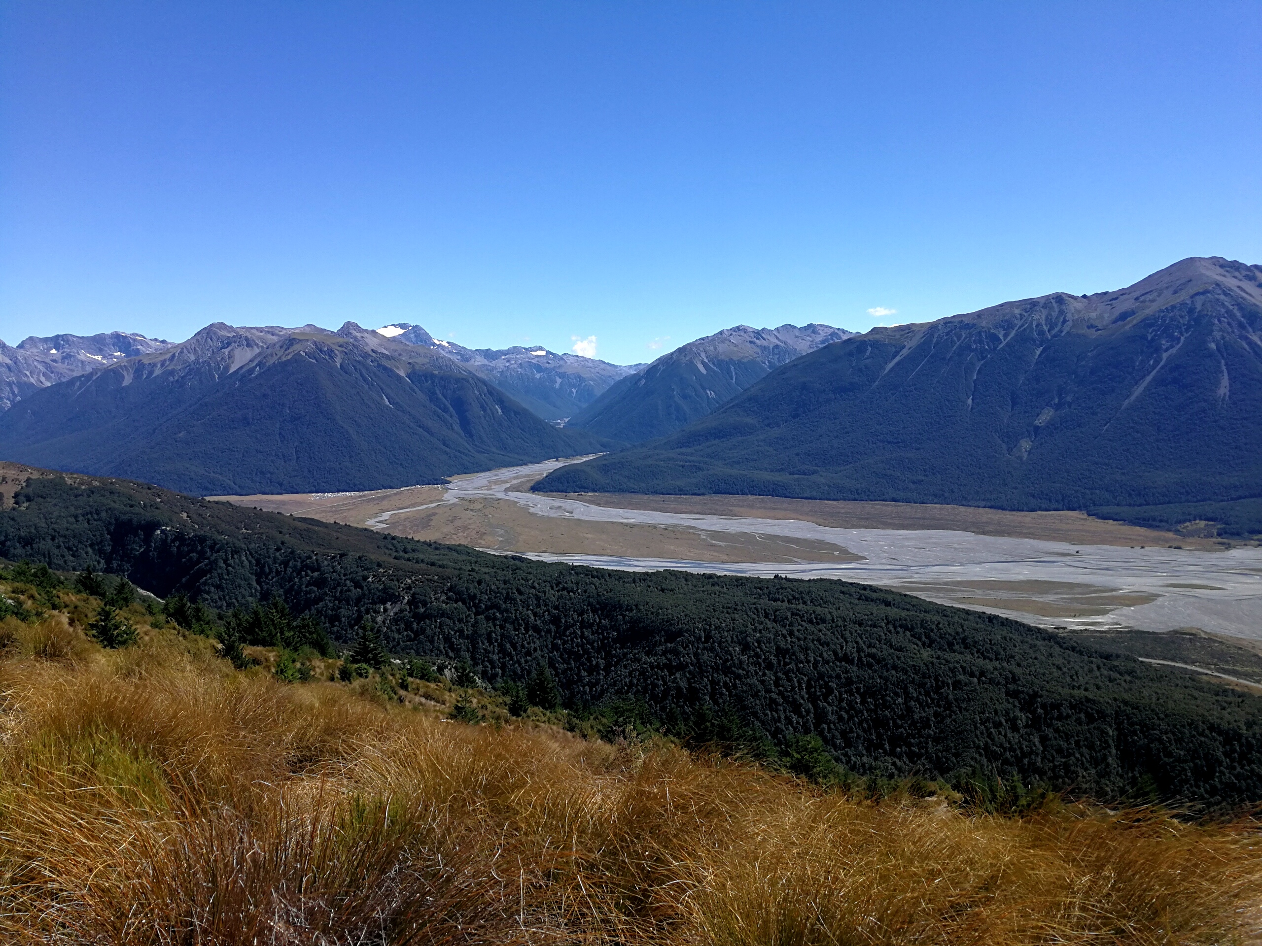
Arthur’s Pass isn’t actually on the Te Araroa, but the 5 of us set off on the road shoulder to make up some of the distance we missed by not doing the Deception-Mingha track. The road was nice and wide and traffic scarce. 5km later and the trail briefly joins the road before skirting back down to the river basin then back up the other side. We decided we’d rather stick to the road than tackle the river.
We paused for snacks and photos at a sign of Arthur’s Pass National Park and carried on in the hot sun. I pulled ahead of the girls without realising, but Sofia and Pontus were so far ahead I couldn’t even see them on the road.
Eventually the trail turned off and I rested in the shade at Bealey Hut. I checked the weather forecast for a last time and saw a message from Sofia – they were having 2nd breakfast at the hotel we passed on the road. The road walk had taken 3 hours and with the sign to Hamilton Hut at the start of the climb saying 7.5 hours, and the fact I wasn’t feeling great, I began to have doubts whether I’d make it all the way today.
Ali and Liv passed by the hut, waving without stopping. I refilled my water then pressed on. It was a steep climb but the track was decent, using long switchbacks in the forest to ease the gradient. There was an abrupt change from beech trees to pine trees, littered with cartoon style bright red toadstools, then back to beech trees. The pines smelled amazing.
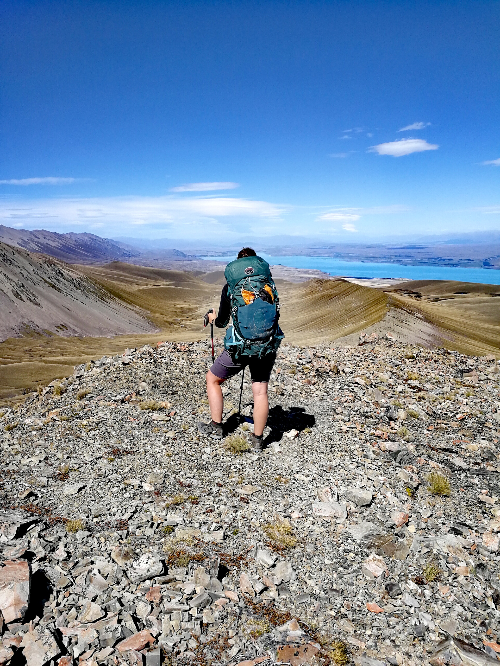
The trail emerged from the trees to open scrubland and the gradient eased but continued climbing, contouring the face of the mountain. The views towards Arthur’s Pass were stunning, with snow on the peaks sparkling against the cloudless sky. I grinned and carried on the well-made path – the first I’d encountered on the TA with drainage channels. I tried to work out what made the stones and dirt change between blue/grey and yellow. Walking along the road below earlier these tops had looked incredibly high, and it always amazed me how much one could climb with a few hours huffing and puffing.
The top was an understated affair, skirting round the edge of the hill side and contouring back down the other side into the trees. Just before Lagoon Saddle Hut I caught Ali and Liv up, which confused them as they hadn’t actually seen me at Bealey Hut, waving to the other couple, so had thought I was ahead of them. We started on lunch outside the A frame hut as Sofia and Pontus arrived, but they pushed on, full from 2nd breakfast.
From the hut it was only 10km to Hamilton hut so we felt better about our chances of making it, but the sign after the hut said 3-4 hours for the 5km to the next hut. Hmm. The trail undulated steeply up and down, gradually making its way down to the river. The path was twisted with roots and sidled at times, making slow going. Riverbed sections had few markings but some small cairns to encourage you in the right direction. I managed to keep my feet dry on the river crossings, hopping across rocks.
Eventually I emerged from the woodland into a clearing at the hut and flopped down next to Sofia and Pontus. I was almost out of water so scrambled down the bank to the river to fill up and filtered it in the shade. I was getting tired, and my shoulders were hurting as I had to have my hip belt looser than normal to try and alleviate the nausea. I was worried that the next 5km to Hamilton hut were going to take as long as to West Harper hut. Spirits buoyed by the Swedish’ antics, and a quick chat with Ali and Liv, I carried on.
The going got easier after the hut as the trail flattened out, but I didn’t manage to keep my feet try for the whole day as I slipped on the rocks crossing a fairly shallow but wide stream. Pah. The path gently undulated next to the river and after crossing 2 swingbridges (1 which had narrowly avoided being squashed by a recent fallen tree) it was a short diversion from the path to the hut.
At 32km it was my longest day so far and I felt it. But it had also had amazing views and great walking. The girls arrived soon after and we chatted with David, a kiwi who’d been walking in these hills for decades, about the changing trail and the upcoming rivers.
I made dinner but couldn’t finish it which worried me, but it felt different from the heatstroke – it was loss of appetite rather than feeling sick from eating. Still, I made sure to drink lots of water.
Day 31: Hamilton Hut to Harper Village/Trustpower campsite
19km, +100m -100m, 4.5 hours
I had my first possum encounter going out in the night, but was treated to a wonderful sky of stars.
Slowly I forced myself to finish my porridge. I tried to summon enthusiasm for the day’s walking as I wasn’t feeling great, but comforted myself that I’d done the harder work yesterday, today was shorter and flatter.
I soon caught up with Sofia and Pontus, and we navigated the repeated river crossings together as a sometimes-disappearing 4WD track looped back and forth across it. It was possibly to stay on one side most of the way but the going was much easier on the track and the river wasn’t a problem. In the times when we lost the track it was a case of following our noses downstream on the riverbed.
Once the path tired of river crossings the track rose up onto a plateau and turned dry and grassy. It made for easy and quick walking, and we chatted away the km. We managed to miss seeing the Pinnacles – a rock formation on the other side of the valley as the clouds were obscuring the tops.
The track eventually came back to the river bed with several more crossings over the rocky flats. After rounding a small bluff the 4WD track rose up to the follow the fence line of a farmstead. The fence was shiny and new and I think it was a recent amendment to the trail as it differed to the GPS track.
At the end of the fence it merged with a gravel road, and I walked on this out of the valley to Harper village where Sofia and Pontus caught me up, having stopped earlier to change from their sandals to boots. According to the map this was the junction for the campsite but we couldn’t see any signs. More worryingly, the ‘road’ south had been visible for the last half an hour of walking and no cars had gone down it in the right direction. Our plan of hitching to Methven from here was looking doubtful.
We went into Harper village – a handful of homes for those working on the farm. Sofia and Pontus knocked on a door (I felt far too British and awkward), asking if they happened to be driving out at some point. He wasn’t, but said his neighbours might and sent us over. We ended up waiting nearly two hours for the two guys to decide whether they were going or not, and then to feed the animals and get ready, but we were very grateful for a ride. The guys had recently moved up here to work on the farm (called stations in NZ) and were driving to Christchurch, almost two hours away, for a night out.
We hadn’t seen Ali and Liv whilst we’d been waiting which concerned us slightly as they shouldn’t be that far behind. A few km down the dirt road however and we saw them – they’d met a DOC worker who said they should cross the Harper River to shortcut the village, despite the river being at the limit of the girls’ abilities. The guys pulled over and offered them a ride as we knew them – we were already full and the girls started to protest but we insisted, they’d have to walk at least 20km until another road joined which might have more traffic. So the 5 of us squeezed in the back. They dropped us on a main road half an hour later, and we (3 of us) soon got another hitch a bit further down the road to Rakaia gorge bridge. The water was a stunning cloudy opal blue, and I went and had a look before hearing Ali call me back – she’d managed to get another ride already, with a lovely cement truck driver who dropped us off outside our hostel, Snow Denn.
Sofia and Pontus arrived just as we were checking in – I’d booked a 5 bed dorm for us from Arthur’s Pass. The plan was to have a rest day tomorrow then on Monday morning get the 6am school bus up the south side of the Rakaia.
Days 32 to 35: Methven
However, waking up on Sunday I decided I needed a few days off. I’d evidently picked up a stomach bug at some point and hadn’t felt great since Arthur’s Pass, so booked in for 2 more nights, with the plan to hitch to Arundel on Wednesday to meet the gang at a camp spot where Alps2Ocean would drop them after picking them up from the north side of the Rangitata. I was never about walking every inch of the TA and decided I would rather continue with friends despite missing a few days of the trail. This surprised me somewhat as I’ve previously always relished my solitude in the mountains, but I was finding a strong preference to not be alone on this trip. I guess it was a reflection of the wildness and difficulty of the trail, but also that being with the same group of friends provided some constant amongst the otherwise ever-changing trail.
By Tuesday I felt back to normal (normal enough to be bored of Methven). I was just finishing my coffee in Primo, eyeing up the drizzle that had started and wondering about my chances of getting a hitch to Arundel when an Alps2Ocean van pulled up outside. I hedged that the man ordering coffee was Wayne and went to introduce myself, mainly to double check where he was going to drop the others so I didn’t go to the wrong place. The legend that he is said he’d back through Methven in a few hours and offered me a lift. Gratefully accepting, I ordered another coffee and sank back into my pile of cushions.
I thought he’d just drop me at Arundel but I stayed in the car up to Potts stream to pick up the others and we decided that a night in Geraldine would be nice, and only $5 more for the lift. 6 more TA hikers were waiting at the Rangitata so Wayne said he’d come back and do another shuttle.
I pitched my tent at the holiday park then went and met the others, and Mike, for dinner at the hotel.
Day 36: Bush Stream car park to Stone Hut
18km, +1300m -650m, 7.5 hours
Wayne picked us up at 7.20am and we were at the start of the path by 9am. The only options for TA hikers to get round this section at the moment are to cross the Rangitata (do-able in a few hours in low flows but dodgy as hell as it can go to flood in under an hour from rain way upstream), take the school bus which goes some of the way up the track then walk the rest to the start, or call Wayne. There are only a few farms up the road so chances of hitching are slim.
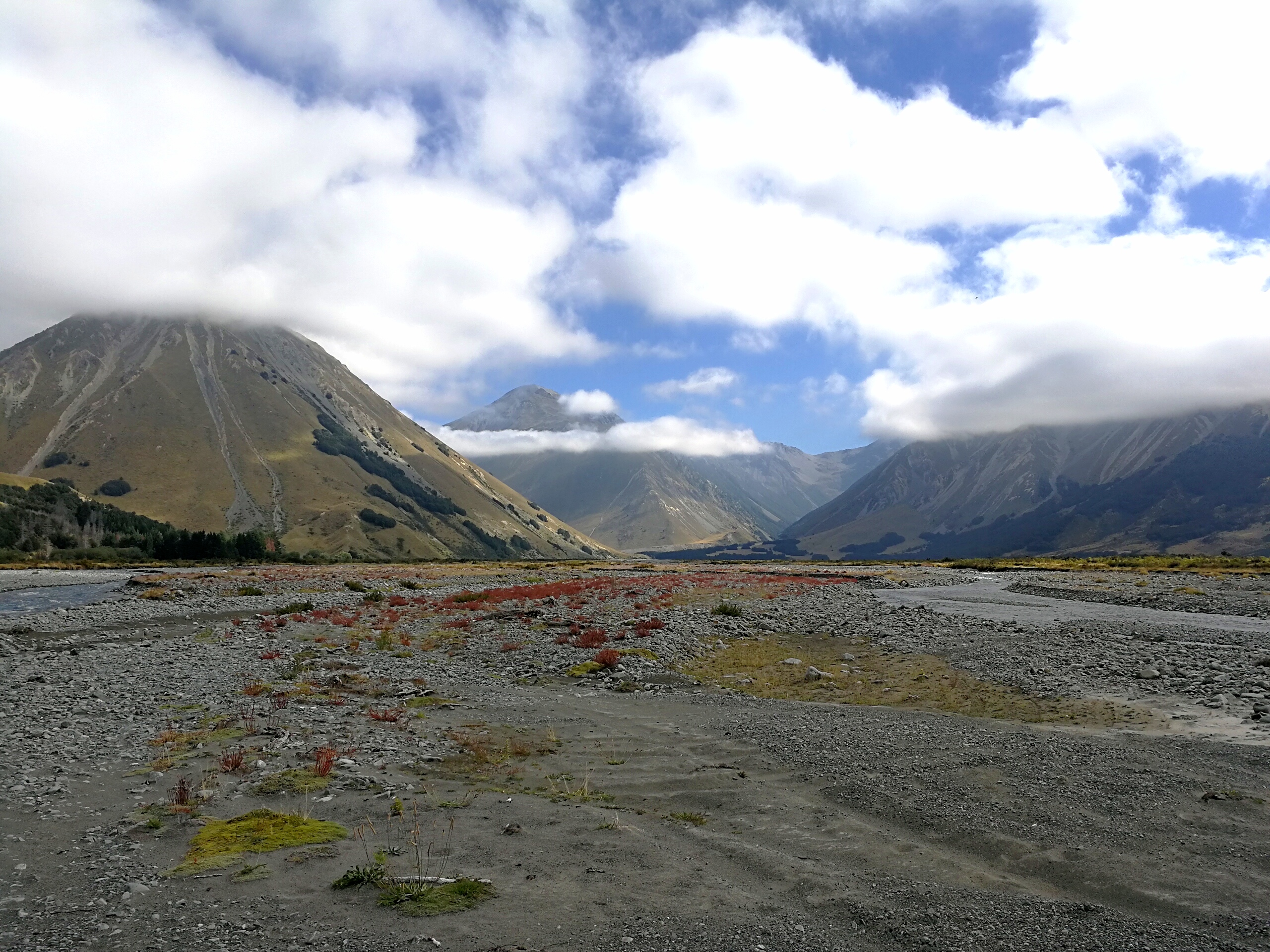
I started walking with Mike along the gravel track to the edge of the mountains. Crossing through a fence, the path disappeared among the pebbles of the wide river bed, with the odd orange pole heading up the river. It was a choose-your-own-path morning, fighting through scratchy gorse bushes and crossing either side of the river a few times to get to easier walking. The river was quite strong but was about knee height most of the time.
As the valley narrowed and turned into a gorge the trail jumped up a steep climb, initially through thick gorse, massacring my legs. Becoming more distinct, the path zig-zagged to the top, where I caught up with Sofia and Pontus for a quick break. From here we could see the trail went straight back down to the river, crossed it again, then straight back up the other side. Sigh.
After crossing the river the path was very steep, and I slowly plodded my way up the 500m climb to Crooked Spur Hut. The views back down the valley were amazing. As we’d had a later start than usual, after only 3 hours of walking I had lunch. The others carried on but then Ali and Liv arrived, having found the river crossings a tad trickier without our height advantage.
The gradient eased after the hut, but continued to climb up through an open tussock valley. I lost the path multiple times and kept tripping over the long grass of the tussocks, or the pitfalls that the grass hid. I’d also managed to hurt my leg at some point in the morning and it hurt every time I brought my right leg forward. Many sweets were eaten in this section.
After the tussocks came scree, and with the wind ever increasing I plodded on to the top. I savoured the joy of reaching the saddle and the views it afforded before heading down the scree slope in an attempt to get out of the wind.
It was soon back to tussocks which on the steeper sections I found treacherous to descend as the dead grass around them were as smooth as ice and I fell on my arse a few times. I also rolled my ankles a couple of times as I couldn’t see the path beneath the grass. I stepped on what looked to be a slightly boggy mound but almost bounced off it. Alarmed, I looked at the offending piece of ground and prodded it with one of my walking poles. It wobbled like jelly. I prodded it a few more times in a mix of disbelief and amusement. I reached the river and stopped for a break and to filter more water as I was almost out.
From there it was a couple more hours of undulating tussock ground, in the hot sun and strong winds, before descending down to Stone Hut. Chris and John, Swiss and German NOBOs, were hanging their washing up out the front as Sofia and Pontus pushed on to the next hut.
The girls arrived a while later and we settled into our simple hut life – drying shoes and socks in the sun, collecting water from the stream and filtering, washing ourselves in the (still icy) stream, cooking our dinners on our stoves around the table and setting up our sleeping bags. We chatted with the boys about our respective upcoming sections, and delighted at being able to sit outside as there were no sandflies.
Day 37: Stone Hut to Camp Stream Hut
20km, +900m -750m, 8 hours
Today was a big day – we had the highest point on the TA, Stag Saddle, and we were (approximately) half way through the south island.
I set off with Ali and Liv, crossing the icy river straight away which made me and Ali, in our non-waterproof shoes, squeal somewhat. The path came and went in places as we picked our way through the tussock on the side of the river. The density of spear grass had increased from yesterday and my legs got another mauling as I failed to avoid the stabbing blades.
We gradually gained height up the valley and in about an hour and a half came to Royal Hut – apparently so called because Princess Anne and Prince Charles had visited when they were kids. We stopped for a snack break and sun cream applications; it was another scorching day.
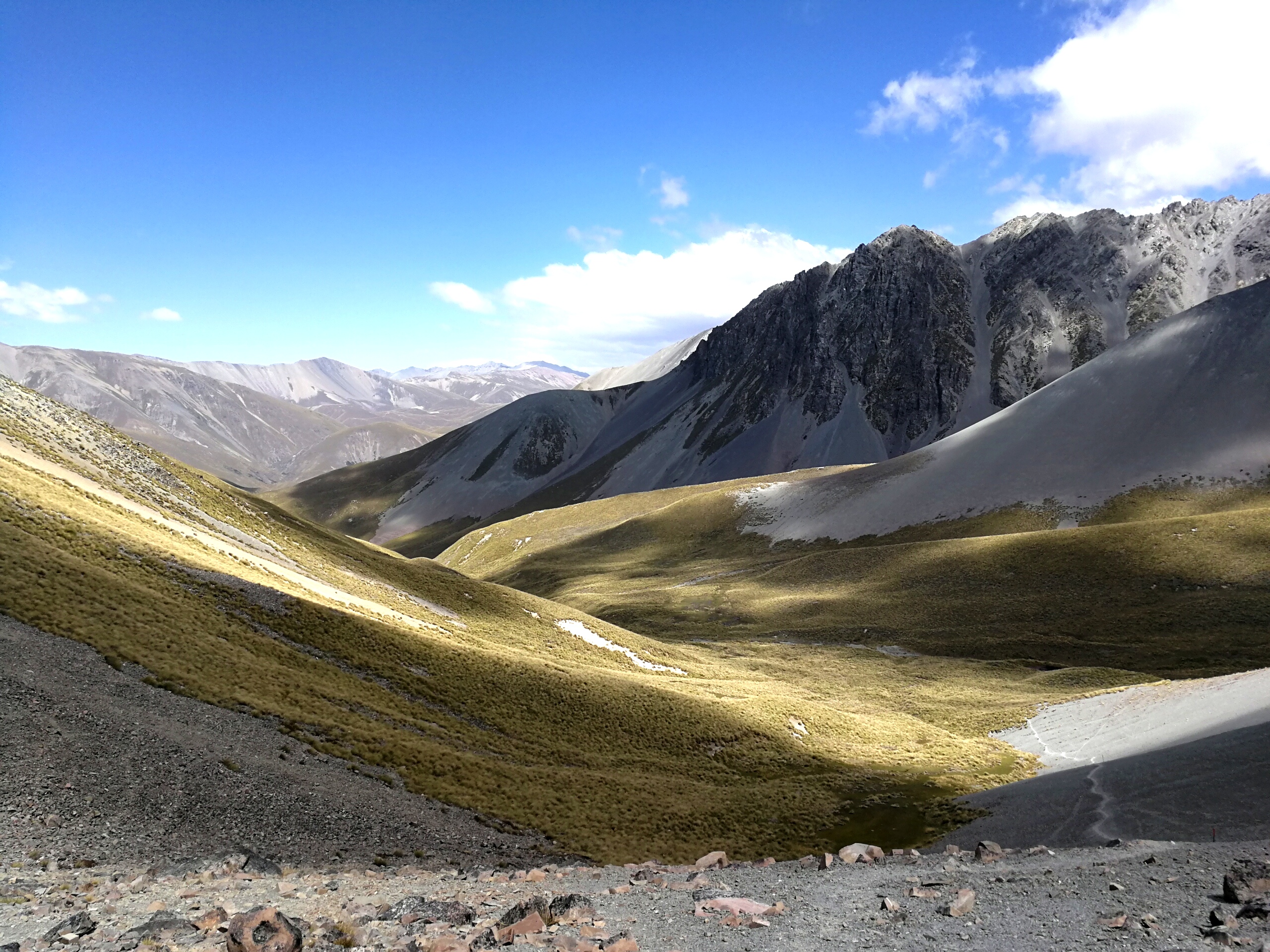
A few orange poles indicated the trail crossed the river and followed a new stream up a different valley. There was no clear path so we picked our away amongst the marshy ground and the rocky slopes. The gradient had only increased slightly but I felt like I had zero energy.
The valley narrowed and the trail left the river to climb very steeply up a grass bank. The girls pulled ahead as I summoned the energy to keep putting one foot in front of the other. It flattened out after a while to cross some boggy ground then the climb continued up a wide basin. The wind would come in strong gusts for a few moments then disappear to complete calm.
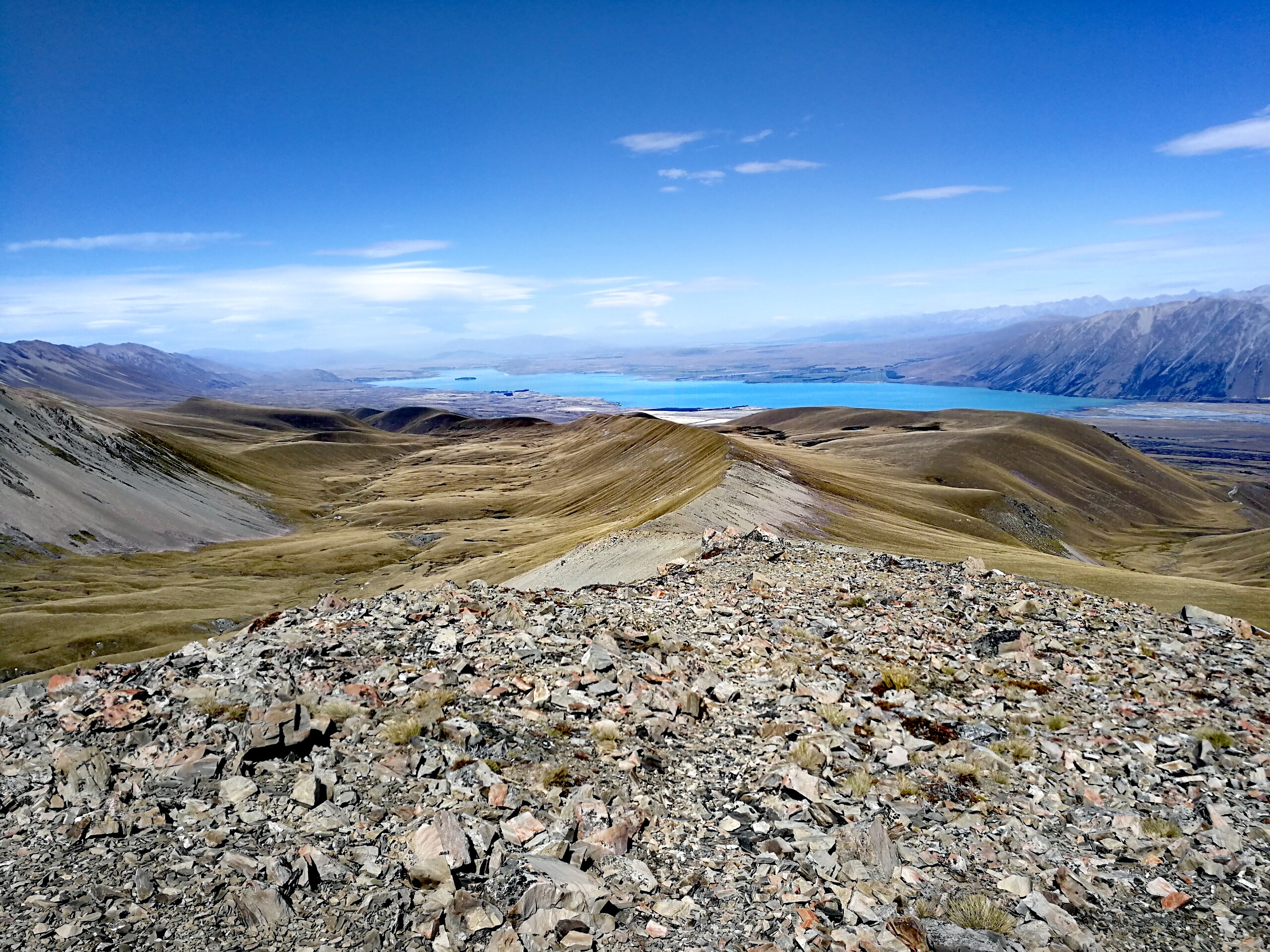
When the final ridge came into view I paused again for a drink and felt relief that I would actually make it. I plodded on some more until I stepped up onto Stag Saddle. I exhaled and staggered at the views down to Lake Tekapo. We dumped our bags down and must have sat there for at least half an hour taking it in.
Officially the TA heads down the valley following a river, but unofficially it heads up onto a ridge for a nicer walk down in fair weather. It was windy but otherwise fine so we headed across the boulder field to where we could see a faint line in the scree slope up to the ridge.
I couldn’t stop grinning the whole way down the ridge path. We had views to Mount Cook on the right, the brilliant blue of Lake Tekapo ahead, and mountains all around.
The path faded near the end of the ridge but some orange poles appeared and we followed them up a few bluffs and then down to a jeep track which led across a river and up to Camp Stream Hut. It was built in 1898 and is maintained by volunteers from an alpine club – it’s a tiny 6 bed hut but no one else came so the 3 of us were cosy.
There was no water source at the hut so it was a stagger down a 50m hill to the river for a wash and collecting and filtering water, then a slow climb back up trying not to get sweaty again. Revelling in the lack of sandflies again we ate dinner outside in the evening sun. Bed by 8.30pm. Amazing day.
Day 38: Camp Stream Hut to Tekapo
28km, +300m -700m, 8 hours
Heavy rain pounded the hut in the night and when the alarm went at 6am we all stayed in bed for another 45 minutes. Reluctantly I got out of my cosy sleeping bag to make breakfast.
It was a cold morning but the rain wasn’t too heavy, and there was a clear path next to the river down the valley. It crossed the river a couple of times and at the start of a 200m climb I shed my waterproofs as the rain had stopped and I was going to overheat in the goretex.
The path climbed steeply out of the valley and then undulated across a wide plateau to cross a ski road. From there the path became an easy 4WD track.

The sky ahead over Tekapo was pitch black, and the mountains we’d come down yesterday were getting obscured by incoming cloud. We managed to stay in the dry gap for a while but it was soon time for the waterproofs to come back on.
The lake was still bright blue even in the murky rain, and a wide rainbow appeared on the far side. By the time the track turned to head down toward the road the rain had stopped and the sun had come out.
We reached the road by 12.30 and had lunch looking out over the lake. There was no traffic on the road for a hitch so it was a long hot walk on the gravel road along the lake.
A couple of hours later a campervan came past and me and Liv hitched a lift for the remaining 7km to town, shortening an otherwise 35km day. We had cake at a cafe and then walked out the other side of Tekapo to the holiday park. It was a bit surreal to come down from the mountains where it had been the 3 of us in a remote hut, to Tekapo which was packed out for Chinese New Year.
Originally we’d planned to have a rest day in Tekapo but all accommodation was full – we only just managed to get tent sites at the Holiday Park – so we booked rooms in Twizel when we were in Methven to have a rest day there instead.
Tekapo is a dark sky area and we had a clear sky – I went out in the night and the stars were incredible. I could see the milky way in such detail and lots of other clusters.
Day 39: Tekapo to Twizel
61km, 5.5 hours
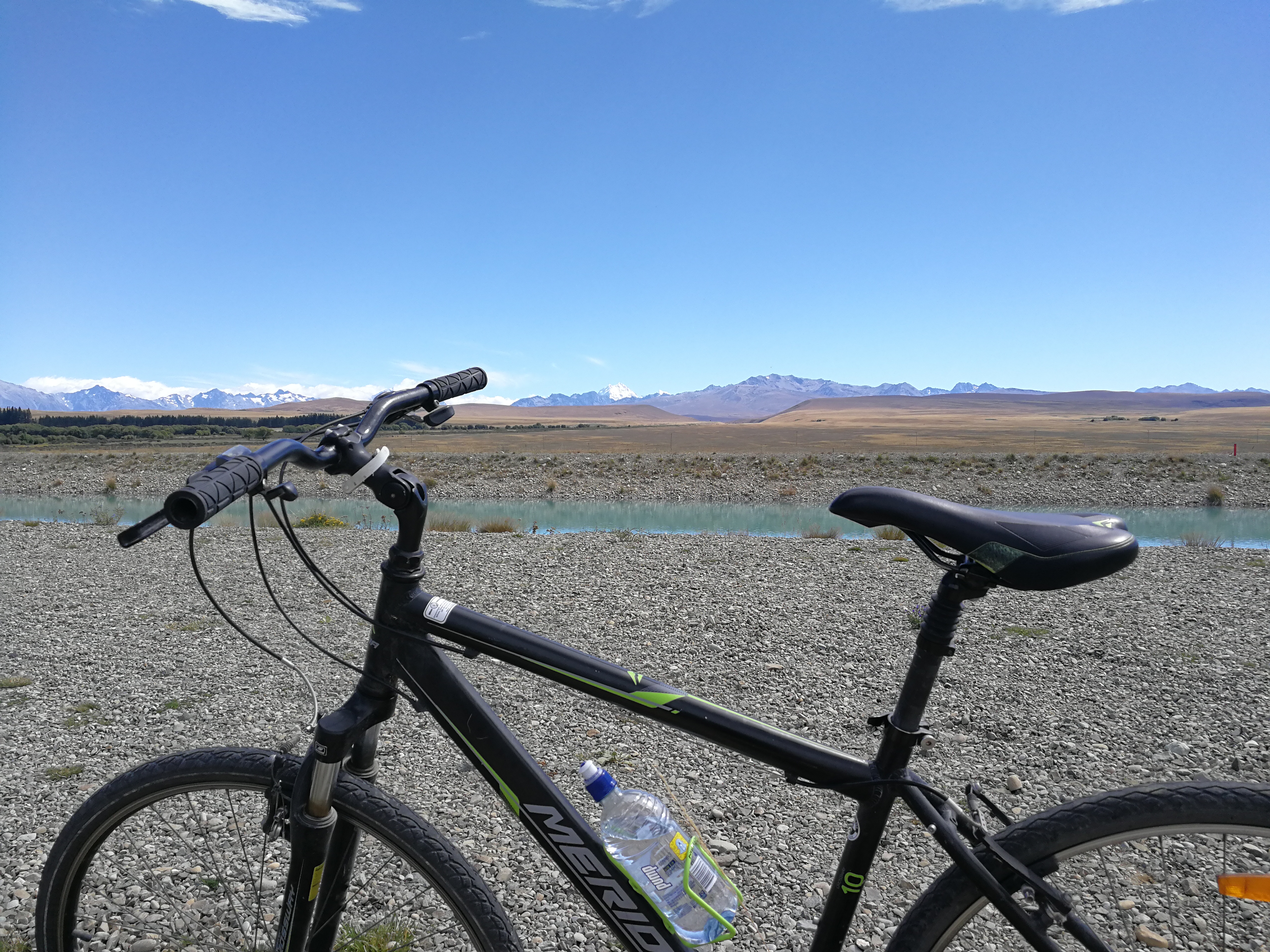
Today was going to be slightly different. It was bike time! The section between Tekapo and Twizel is on a flat canal path that would be kinda dull and too long to walk (you can’t camp along the way on this section), so we hired mountain bikes from good ol’ Wayne at Alps2Ocean and he took our bags to Twizel.
We had a leisurely cooked breakfast in town and brought a packed lunch from 4 Square before setting off. It was a gravel track over a small hill and then we were down onto the canal road, which alternated between gravel and tarmac.
The canal was the same brilliant blue as the lake, and it felt great to be moving so much faster than walking. The sun was shining and the mountains provided a stunning panoramic backdrop.
The gravel sections were quite hard work and some were very exposed across the plains with strong cross or head winds. I had to steer and lean into the cross wind in order to not get pushed off the road at one point. We soon changed direction though and it was smooth sailing past a salmon farm and downhill to Lake Pukaki where we stopped for lunch by the shore, with views up to Mount Cook again at the end.
The trail soon left the road and we were on a gravel section of the Alps2Ocean cycleway (not related to Wayne’s company…yes it was confusing) which had a compacted groove in the middle so it was easier cycling. This undulated around the end of the lake and we stopped at the Pukaki visitor centre for an ice lolly.
We continued on the canal road rather than a deep gravel section so it was smoother riding but there was a long section right into the strong headwind, so progress was rather slow. When we turned off the canal for the final 5km to Twizel we finally had a tailwind and practically flew along to the backpackers. It was the longest I’d ridden without bib shorts and we were all rather sore and tired from the wind, but still a great day.
Once we’d recovered, showered and met up with Sofia and Pontus, our attention was then devoted to finding somewhere to stay to wait out cyclone Gita, which having smashed through Tonga and Somoa was now heading straight for New Zealand. We found a lodge holiday house in Ohau and booked for 2 nights, then went to the pub for dinner.
Day 40: Twizel
Classic rest day – lie in, pancakes for breakfast at a cafe, resupply food shop, read the trail notes for the next section, sewed up a hole in my shoes, generally tried to move as little as possible. I’d had a rather emotional few minutes in Tekapo when I thought I’d left my GoPro in the guy’s van who gave us a hitch, so went to Twizel’s library and backed up some of the videos and photos. Leisurely day rounded off with loaded curly fries with pulled pork whilst watching some of the Winter Olympics.
Loving reading all of this. Sounds like you are having a very special trip and I have to say I bow to your energy and tenacity!
Much love
John