September 2016
You can read about how I prepared for the hike here and here, read my hints and tips, and watch the video I made. This is a day-by-day account of the hike with info for those thinking of doing the route. If you are, do it, it’s incredible. Also, grab a cup of tea, because this might take a while.
Typically I’d start walking by about 8am and arrive at my accommodation between 3pm and 5pm. If the forecast showed a storm in the late afternoon, then I’d start a little earlier.
Day 0 – Travel
I like trains, and chose to get to the start by train rather than flying. Thursday 1st September 2016 saw me take 2 buses, 2 subways and 3 trains to travel from Oxford to Zurich:
Home – Oxford train station
Oxford – London Paddington
St Pancras – Paris Gare du Nord
Paris Gare de Lyon – Zurich
Zurich – youth hostel
I stayed in Youth Hostel Zurich (CHF 49 for a bed in a 6 bed dorm), and it was probably the worst night’s sleep of the whole trip. The hostel was okay, it was just very hot and my room mates were impressively loud snorers.
Day 1 – Zurich – Alp Siez
16km, 709m up, 16m down
Highs: realising I was actually starting the walk I’d been thinking of for months
Lows: despairing at how heavy my backpack felt
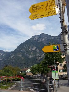
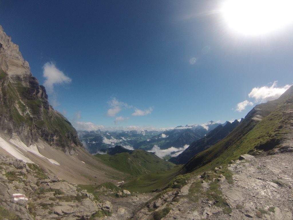
I got the bus back to the main Zurich train station, then took a train to Sargans. Apparently, the trail starts here, but I couldn’t find it (great start) so made my own way over to the suburb/village of Mels, where I found the soon-to-be familiar yellow signs and Via Alpina 1 sign.
The guidebook calls this section ‘undemanding’ but I was inclined to disagree, as were the American trio I met half-way up the valley, who were also starting their Alpine Pass Route. With hindsight, this was indeed an easy day compared to the rest, but at the time it was a bit of a shock.
I filled up my water bottles from a wooden trough outside someone’s house in Schwendi. The guidebook suggests ending at Weisstannen but I carried on 1 hour further up the valley to the farm of Alp Siez – a charming farmhouse on it’s own between the mountains and meadows. I slept in the loft, and there was a set 3 course dinner at 6.30. Breakfast included cheese from the cows in the field next door, and was delicious.
Alp Siez: CHF70 for a mattress in the loft, including a set dinner and breakfast. Pillows and blankets provided (you’ll want a sleeping bag liner).
Day 2 – Alp Siez – Matt
19km, 1030m up, 1261m down
Highs: first alpine pass, with stunning views
Lows: getting half way up a steep scree slope the wrong side of the valley before admitting I’d gone the wrong way
I figured once I’d managed to finish day 2, which included the first (of 16) alpine pass, I’d know how I was going to fare for the next 2 weeks. This didn’t start of too well, as after I’d negotiated a herd of cows plodding along the road, I was walking too fast with my head in the clouds, and failed to acknowledge that I’d already crossed a stream. The guidebook said after crossing a stream, follow the path to the right. There happened to be another stream crossing just ahead, and another path led off to the right. Just the other side of the valley. By the time the trail had fizzled out amongst dense vegetation, with scree river beds, with no waymarks, and the terrain getting steeper, I re-read the ‘well-graded and looping path’ and figured I’d probably gone the wrong way.
I’d been tempted to carry on and see if there was a way across, but when I was back on the real trail (clearly waymarked and very obvious) and looked across I could see the steep cliff the other side of the peak. After amusing the Americans when I appeared behind them despite setting off before them, the real climb up to the pass began.
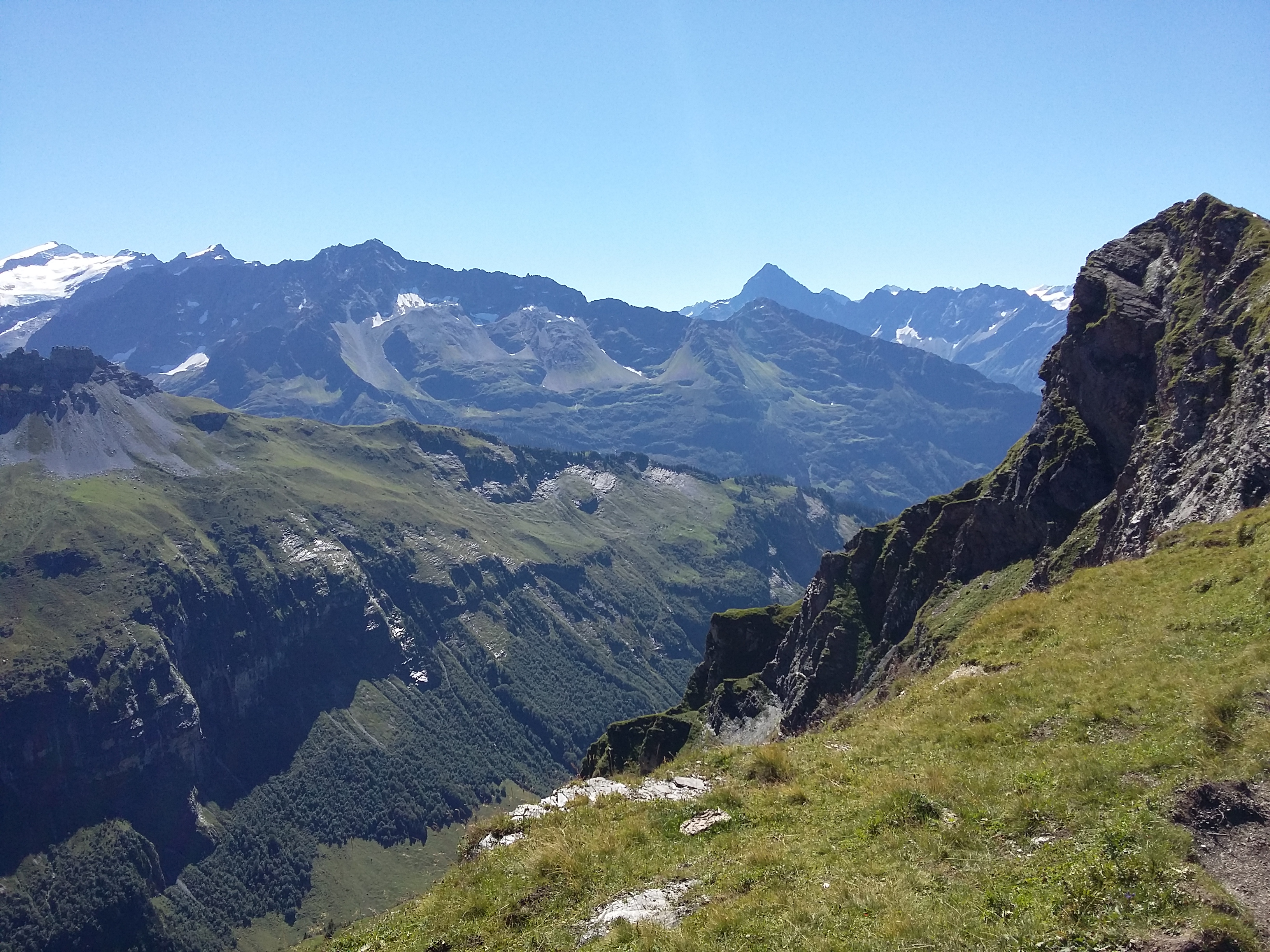
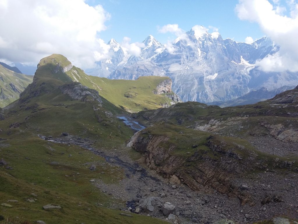
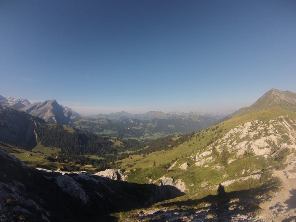
It was another clear sky and a hot sun, so I was dripping with sweat in no time. The path was well waymarked, and after filling up water bottles by Fooalp, I plodded on to the top. Cresting the ridge and seeing the next horizon of mountains was something that stopped me in my tracks every day.
Elm was a pretty little town/village, but I was staying about an hour’s walk up the valley in Matt – I took the bus.
Gasthaus Jagerstubli: CHF51 for a single room and breakfast, bedding provided.
Day 3 – Matt – Braunwald
27km, 870m up, 1732m down
Highs: walking with George and Denise
Lows: 1700m descent!
I was going to take the bus back to Elm, but it carried on up to Ober Erbs so I stayed on. Thankfully the bus-load of families got off one stop before and must have been doing some day walks in the valley, for only me and a Swiss couple started on the path to Richetlipass. We leap-frogged each other as we each took breaks.
After reaching the first crest, the trail opened up into a basin of pasture surrounded by peaks, and we could see the trial zig-zagging up the other side. I was surprised at how many flowers were still in the meadows – I thought the cows would have eaten them all by now.
Reaching the Richetlipass, it was 1700m down to the valley floor. Unsure how my knees would react to this, I took it steady, and was thankful of my walking poles. At the bottom of the steeper part down moraine slopes, George and Denise caught me up, and we walked the last 700m descent together. Their presence made the descent pass a lot quicker, and I enjoyed their company. They were doing a section of the APR, and had met the Americans earlier – I wouldn’t see them again.
Reaching Linthal, I filled my bottles at a fountain, and took the funicular up to the car-free town of Braunwald. I looked back across the valley, picking out the pass I’d walked from. The forecast had been for rain to come in the afternoon, and 10 minutes after reaching my hostel the rain arrived and the views were lost.
Adrenalin Backpackers hostel: £39 for a single room and breakfast, no bedding provided.
Day 4 – Braunwald – Attinghausen
About 2km?
Highs: cake
Lows: skipping a stage
Due to the length of this stage I’d always planned to take the bus for some of the section as I didn’t have time to split it into two, but with the driving rain and wind, and the state of my shoulders, I figured a rest day wouldn’t hurt. A lot of the trail goes on or near the road anyway, so I didn’t feel too guilty.
I had a wander around Altdorf in the rain and took some more cash out before heading to my hotel in Attinghausen, and raiding the corner shop for carbohydrates and chocolate.
Hotel-Gasthaus Krone: CHF85 for a single room and breakfast.
Day 5 – Attinghausen – Engelberg
28km, 770m up, 1291m down
Highs: having a beautiful mountain all to myself, seeing my first marmot
Lows: can’t think of a thing
After a bungled attempt at hailing the cable-car operator in german, I asked in english and was promptly requested to step inside the on-demand lift. Rising above the clouds blanketing Attinghausen, I emerged onto the gloriously sunny climb to the Surenenpass. The clouds swirled from below, sometimes moving across and blocking visibility, but they would be gone within seconds.
The climb was never too steep, and just as I was lamenting that I was yet to see a marmot, I realised I was staring directly at one. He was sunbathing on a rock, and skittered away when I got too close.
I crossed my first and only snow patch on the APR. It was only a few metres wide and there were clear waymarks the over side, so easily navigated with the aid of my poles. I kept looking back towards the Klausenpass to take in the marvellous view.
The other side of the pass there were a few stream crossings, which would normally be a non-event, but due to the amount of rain that was still draining from the mountains from yesterday’s storms, there was one particularly dubious crossing. The river was flowing fast, about 3 metres wide, and had submerged the rocks intended for aiding with crossing. After looking up and downstream for shallower/narrower crossings, I tentatively waded across, testing each new rock with my poles to check for their sturdiness before moving forward. I later met two ladies in the youth hostel who had tried to cross but turned back.
Youth Hostel Berghaus: CHF36 for a dorm room and breakfast, bedding provided.
Day 6 – Engelberg – Meiringen
31km, 1022m up, 575m down
Highs: sparkling lakes and panoramic ridge walks
Lows: rowdy school groups
This is another stage I would recommend splitting into two if you have the time, for I took a gondola both upwards at the start, and down to Meiringen at the end. It was a bit of a jolt from the previous day’s deserted Surenenpass, as today was more of a tourist hotspot, with chairlifts scattered about.
Nethertheless, it was a gorgeous day’s walking. The reflection of the mountains in Trubsee sparkled, as long as you ignored all the construction work going on behind.
I took an alternative route from the guidebook in the second half of the day, rising to the Tannensee and walking along the ridge and balcony walk to Planplatten. I stayed sitting on the edge of the ridge for a while, enjoying the views down to Meiringen and across to tomorrow’s walk
On arriving at Simons Herberge the owner exclaimed at me, and explained that as the hostel was full of teenagers he was putting me up in a friend’s hotel in town, for the same price. He didn’t speak much english, and it was an example of the kindness I met from almost all the Swiss, and gratefully received.
Simons Herberge/Hotel Adler: CHF45 for a dorm room and breakfast.
Day 7 – Meiringen – First
19km, 1572m up, 50m down
Highs: sunset and sunrise viewed from >2000m
Lows: freaking myself out in the woods
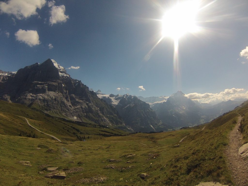
Today was all up hill, as I was going to stay at a chalet at 2100m, overlooking Grindelwald. The ascent started steeply, and I criss-crossed a few cycle tourers who were winding their way up the road switchbacks, whilst the path went straight up.
As the gradient eased, the trail followed a river for a while, which I enjoyed due to the cold air it brought with it. The trail stayed fairly close to the road most of the day, and every now and then I’d hear the musical horn of the Post Buses as they went round hairpin bends.
Leaving the road, and diverted around a section that was closed due to rockfall, the path wound its way up through dense forest. I don’t know what it is about forests, but sometimes I end up spooking myself being alone in them. I also hadn’t seen any red and white stripes for a while, so was beginning to wonder if I was on the right trail. In a clearing I sat down on a log and munched on some wild raspberries, and checked my position with google maps. I wouldn’t rely on it in the mountains, but it was a reassurance that I was at least headed in the right direction.
Eventually I reached Grosse Scheidegg, which had a hotel and kiosk and I’d been looking forward to getting a cold drink, but at £5 for a coke, I passed on principle. The main route carries straight on down to Grindelwald, but I beared to the right, and took an undulating balcony path up to First. I was again the only person in the dorm room, and there were only 2 others staying.
Berggasthaus First: CHF100 for a dorm room, 3 course set dinner, drink and breakfast, bedding provided.
Day 8 – First – Lauterbrunnen
19km, 1118m up, 1361m down
Highs: sunrise over the Eiger, and a wolf!
Lows: poisonous leg becoming painful
I woke by chance at about 6am, and looked out the window as the first hint of light was touching the sky. I put some layers on and stood outside for a while, watching the sun hit the peaks of the mountains. Then I went back to sleep before breakfast.
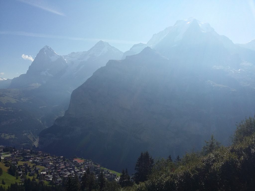
I took the cable car down to Grindelwald, cutting out 1100m of descent. The ascent out of town was in the sun, and I was soon once again very sweaty. The path was mostly paved or gravel at first, and the train going up to Kleine Scheidegg would appear every now and then, full of people looking at me confused.
Passing into the shadow of the Eiger, and the ascent easing, it quickly became much cooler. When I could see the shadows receding towards me, I stopped to watch the sun rise again up over the Eiger.
Emerging into the hubub of Kleine Scheidegg was bizarre; I’d been in solitude for most of the morning, and suddenly there were hundreds of people milling about on the pass. I lingered only to use the facilities, then trundled on down towards Wengen.
The main path became a 4×4 road, but I took a slightly longer trail through the forest near the cliff. Work was ongoing on the trail, and the air was filled with pine from the new logs laid on the switchbacks through the trees. Compared to the forest the day before, I felt at ease through this. Right up to the moment I turned a corner and saw a wolf blocking the trail. I froze, he froze, and we stared at each other. George and Denise had mentioned wolves in Switzerland, but I hadn’t thought I’d actually see one. After a few moments he loped off, and I cautiously carried on.
I emerged below Wengen having cut the corner slightly, and started on a long series of switchbacks to descend to the valley floor and Lauterbrunnen. About half way down this section my left calf started hurting whenever the sun was on it. I’d noticed something on my calf a few days ago, but thought I’d just caught the sun. It hadn’t faded though, was very hot, and after a few days was painful to touch and under UV, and it was pretty lumpy. By this point I’d convinced myself I was dying, so after a chocolate break to boost my morale, I sped on down to the hostel.
I asked about a pharmacist or hospital, and the receptionist phoned the only small doctor’s surgery in the town, and said I should go over before it shut. I was seen within 15 minutes. Without me remembering any insect bite or contact, his best guess was that I’d brushed a poisonous plant. He gave me some cream, and reassured me I wasn’t dying. Phew.
Valley Hostel: CHF41 for a dorm room and breakfast (CHF35 without), bedding provided, self-cater possible.
Day 9 – Lauterbrunnen – Golderli
21km, 1090m up, 1268m down
Highs: alp milkshake, lasagne
Lows: should’ve bought some more apple pie
After well-wishing several of the hostelers doing the Jungfrau trail marathon, I took the gondola up to Murren. I somehow went the wrong way, but the trail merged with the proper route soon enough. It was another glorious day, and I looked back on the row of mountains – Eiger, Monch and Jungfrau.
The elevation profile for this stage shows a little bump shortly before the Rotstock hut. It felt significantly more than a little bump, and there is an alternative route that skips this and arrives at the hut without the extra height. I hadn’t generally been stopping at the alp huts, but I saw a sign for milkshakes, and I was making good time, so stopped in the sun. Definitely worth it, alpenmilk shake and apple pie. I also met another two parties trekking the APR at the hut – an english/australian couple, and four americans. We compared notes and destinations before I continued on, eager to get ahead of a large group that were just arriving.
Once out of sight of the hut, the land seemed to become much wilder and rugged, and I was grateful the weather remained fine as I crossed the Sefinenfurke.
Berggasthaus Golderli: CHF69 for a dorm room, set 4 course (amazing) dinner, drink and breakfast, pillows and blankets provided.
Day 10 – Golderli – Oeschinensee
13km, 1395m up, 1244m down
Highs: chocolat chaud and apfel cake at the highest pass watching the clouds roll over the peaks
Lows: crowds (as much as can count as crowds on the APR)
Yesterday’s evening storm meant I got wet trousers from the damp vegetation on the ascent, but it had cleared the air and the sun was back. The sun cream I had applied must have been sweated off within half an hour.
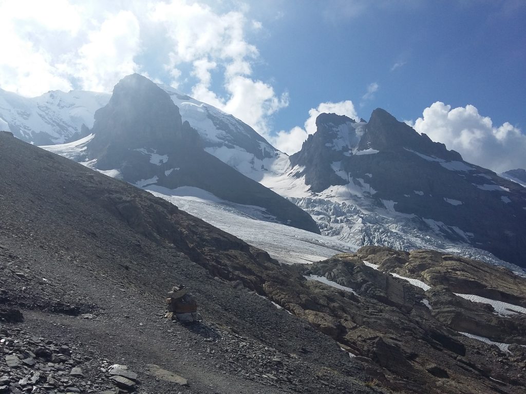
The climb soon turned into steep black moraine, heavily eroded, and there were a few times I had to watch my footing. After an area of rockfall, the climb continued on a series of fixed ladders and steps. It felt quite exposed, and I used my hands on some of the steps as well to steady myself.
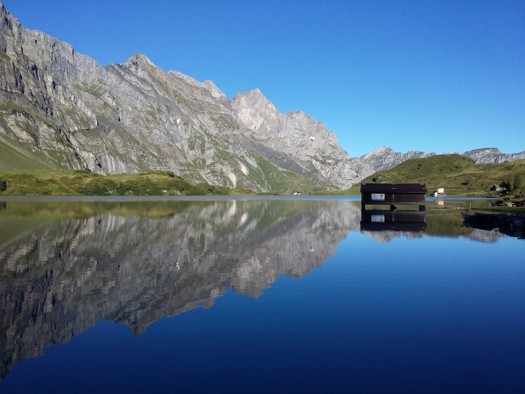
The Hohturli is the highest pass on the route, but the Blumisalphutte is 60m higher, and well worth visiting for their cake. As I didn’t have too far to go after, I stayed sunbathing (in coats) for over an hour, having refills of both hot chocolate and apple pie. The views were stunning, and each time I thought a cloud bank was going to cover them, as soon as it crested the ridge it melted away.
Two hours later I arrived at the Oeschinensee hotel, and the lake was busy with day-trippers using the chairlift. I had dinner outside and watched the sunset against the rock faces of the lake.
Hotel Oeschinensee: CHF93 for a dorm mattress, dinner, drink and breakfast, bedding provided.
Day 11 – Oeschinensee – Adelboden
16km, 1209m up, 1446m down
Highs: looking back at the horizon and knowing I’d walked from there
Lows: accommodation choice
As I’d had a shorter day yesterday, I was making up for it today. I started early and quickly descended to Kandersteg. This was one of those days where I looked up at the mountains the guidebook joyfully said we were going to walk through, and I had some reservations about how far away and how far above they were. But, by putting one foot in front of the other, you can eventually reach anywhere.
A third of the way up, on the pastures of Usser Uschene, there appeared to be a cliff face in place of a trail. I obediently followed the plentiful waymarked rocks, and it became clear there was a good trail, just zig-zagging amongst the rocks so you can’t see it from below. The final ascent to the pass was across a large scree slope. This was a gentle gradient until the last 20m where there were some very steep and soft slopes, which required careful footing and anchoring with the walking poles.
The views from the Bunderchrinde were fantastic, and I was a little awestruck when I looked back and could see the Oechinensee and the Hohturli pass that I had crossed the day before – I had walked from the horizon. And the one before that, and the one before that…
Now, my accommodation for tonight was the only one I had to pay in advance, along with lengthy booking forms, whereas the others were fine with a simple email using google translate. It was a world girl scout centre, out on the edge of Adelboden, and it was a bit weird. I mean it in the nicest way possible, but it felt a bit like I’d walked into a cult. Everyone was weirdly chirpy and smiley (perhaps they were just American), they held hands and sung a lot, and said a lot of oaths.
Our Chalet: £55 for a single room, bedding provided, self-cater.
Day 12 – Adelboden – Lenk
13km, 695m up, 888m down
Highs: ice cream
Lows: receiving 73 insect bites on my arms overnight
I had left the window open for a time in the evening (without the lights on) because it was so hot, but deeply regretted this come morning. I woke up with SEVENTY THREE bites on my arms. They stayed small, but were incredibly itchy despite the antihistamines, and had pus-blisters. Maybe they were bed bug bites? Lovely.
The true mountain passes were finished yesterday, but today’s was still very enjoyable, and a welcome easier walk after several hard days. The first section followed a mountain river which helped cool the air. There was a gondola that goes from the bottom all the way to the top, but it was a nice walk, and I felt like I deserved my ice cream at the restaurant at the Hahnenmoospass much more than the group from the girl scouts who had ridden the gondola up.
Mountain Lodge Backpacker: CH35 for a dorm room, bedding provided, self-cater.
Day 13 – Lenk – Gsteig
22km, 550m up, 1267m down
Highs: ridge walking through limestone boulders with views back across the Bernese Oberland
Lows: lack of ice cream
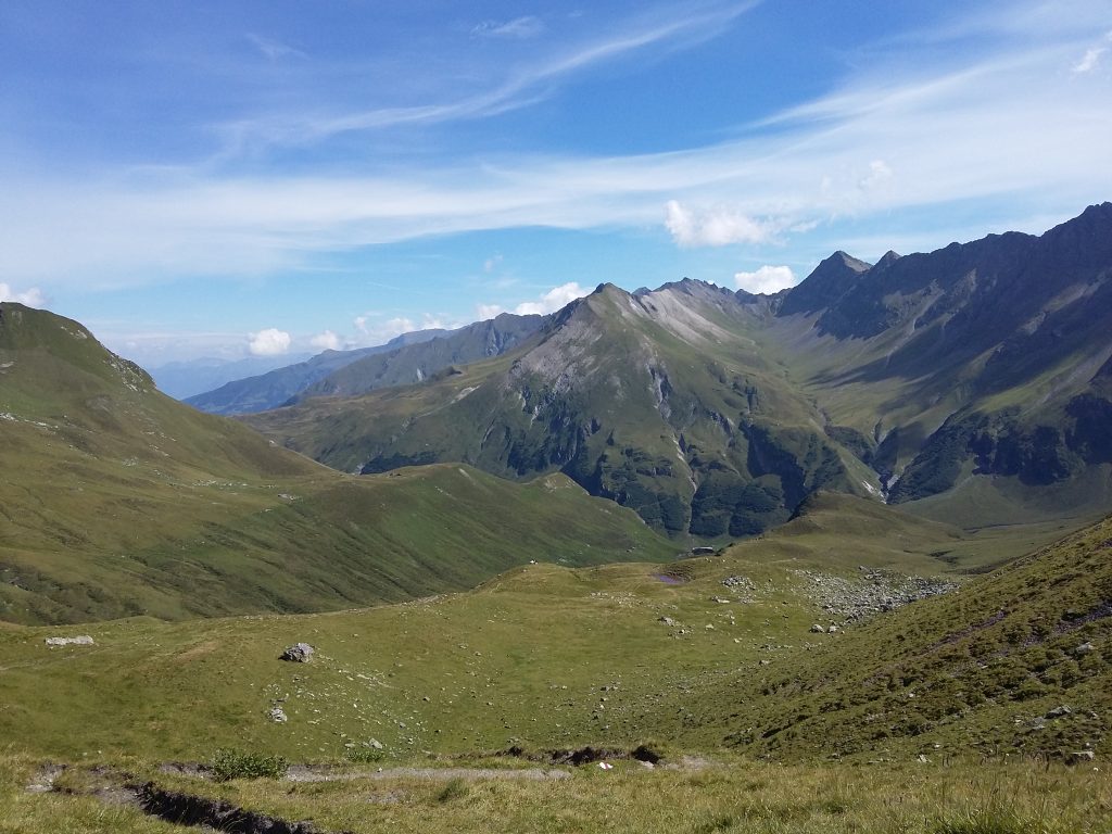
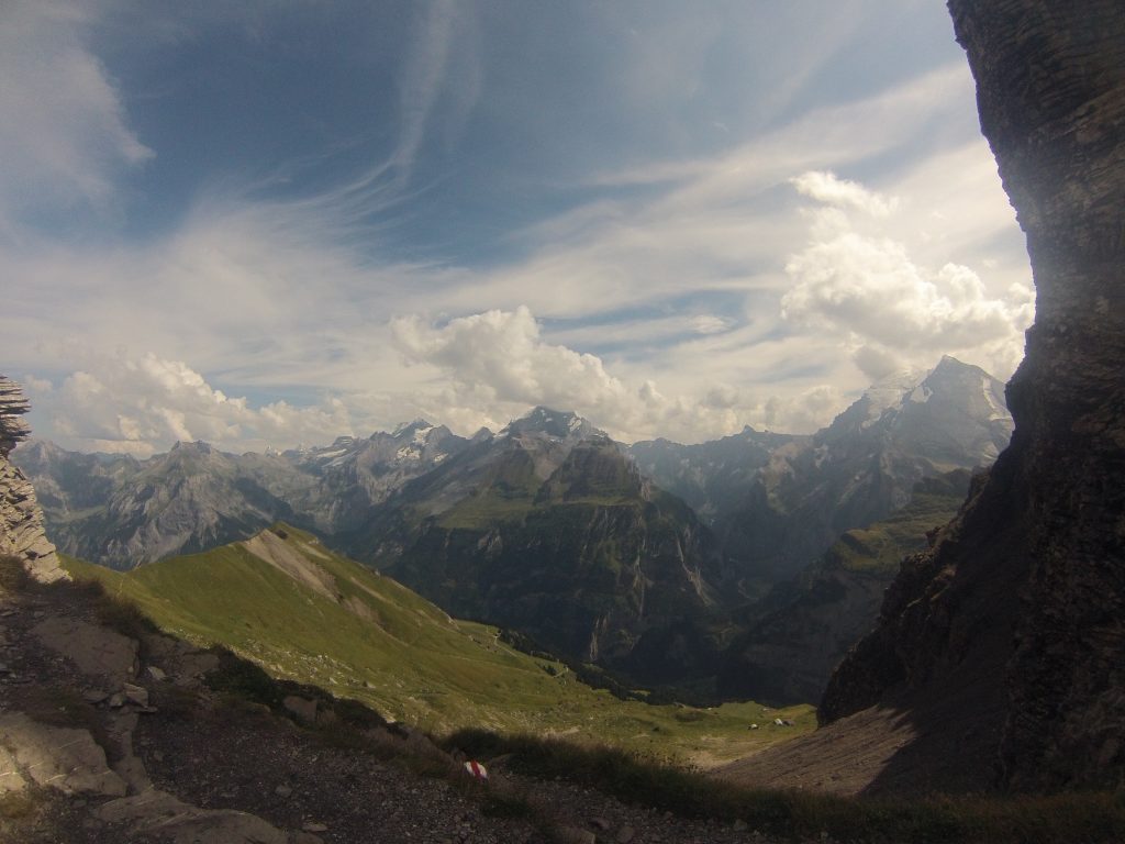
Today featured two smaller passes, which confused my legs somewhat, as they were used to going uphill all morning and downhill all afternoon. I took the Lieterli gondola in the morning, saving 900m of ascent. It also meant the route went through interesting terrain of limestone ridge boulder fields, which was great fun. Looking back I couldn’t quite see the Bunderchrinde from 2 days ago, but the edge of the Bernese Oberland was still impressive. Looking forward, it was slightly daunting knowing that I had to walk to the bottom of the mountains on the horizon for today’s rest.
The descent was leisurely, but I had my first incident with cows, that was to become a theme for the last few days. The path went through their field, with no way round, and I hadn’t had any issues so far so walked on as normal. As I got closer, one cow turned to stare at me, then walk towards me, head shaking around with its fast pace. Perturbed, I hastily backtracked. The field was on a curved slope, so I descended to the bottom of the field, out of sight of most of the cows, and tried to get across through the deep tussocks as quickly as possible. I found the trail again, and carried on, glancing behind to check I wasn’t about to be stampeded.
I arrived at Lauenen just in time for all the shops to be closed for lunch, so after re-filling bottles from the fountain and using the facilities at the bus station, I carried on up to the Krinnen Pass.
Arriving at Gsteig I walked through the small village to my lodgings, where after waiting for the owner to arrive, I had an awkward conversation with me speaking english and a few words of german, and he not speaking any english. He evidently thought I had a tent and was camping, I disagreed. With smiles and large hand gestures we communicated fine in the end.
I highly recommend the Hotel Baren for dinner, the food was astoundingly good, and very unexpected. Stephen the head chef and owner was fascinating company. For dessert I asked for the most calories, and it didn’t disappoint.
Heiti: CHF75 for a single room, bedding provided.
Day 14 – Gsteig – Col des Mosses
23km, 1050m up, 780m down
Highs: 9 hours in the mountains
Lows: cows
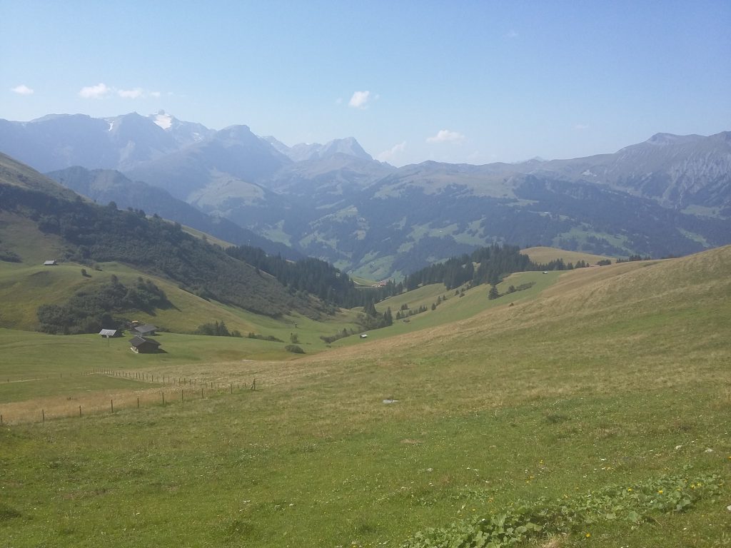
The weather had turned, and the blue skies I had been enjoying for the last 2 weeks had finally ended. Today was a waterproofs day. It turned out better than the forecast, and it varied between rain, drizzle, and just low cloud. It was also the longest day of walking.
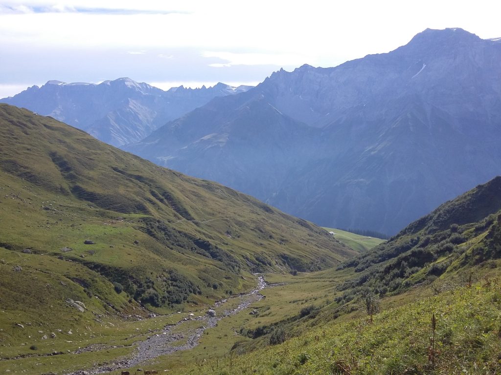
I didn’t meet any other walkers (maybe the weather?) but did see two chamois who ran off when I came round the corner. The guidebook raved about fantastic views all the way back to the Eiger, but I had to settle with Arnensee in the first valley, which was doing its best to sparkle in the drizzle. I crossed the Col des Anderets in thick cloud, and only emerged from them about 500m lower.
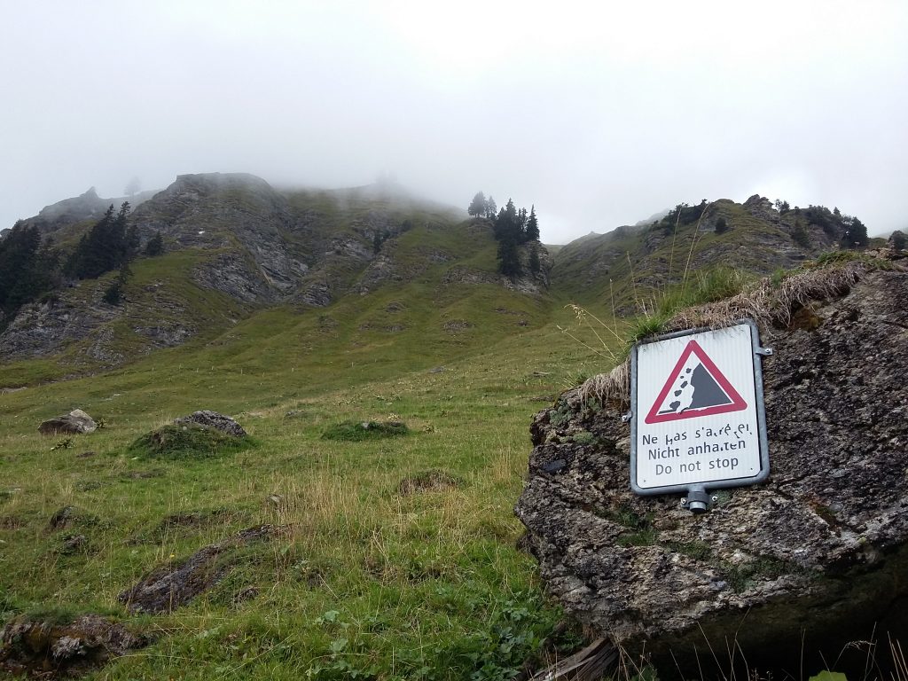
I missed a turning off for the path, but soon realised and re-read the guidebook. A small voice in my head suggested I take the cable car down to Les Diablerets and get the bus to Col des Mosses instead. I shushed the voice with some chocolate, and took a side track which I was fairly sure would rejoin the path without having to backtrack up some of the hill. Fortunately it did, rather than taking me to someone’s house, and the trail continued on a balcony walk with a warning sign not to linger due to falling rocks.
There were two more fields of cows that had to be negotiated. I wasn’t entirely sure what a cow would do to me upon reaching me, nor of the appropriate response – would running away from them make them charge faster? Should I stand my ground and yell at them? Fearing any action would be the wrong action, I tried to swerve around the angry one(s), walking fast, and started singing to myself – more to remind myself to breathe than to placate them, I think.
When the path came on to a road I was grateful, hopeful this meant no more cow fields. Eventually I emerged above Col des Mosses. My original booking had been at Chez Grillon, but I had misjudged how much further and higher above Col des Mosses this was. Weary and damp, I decided to stay at Hotel le Relais Alpin in the town instead. Thankfully I was now in the french-speaking region, so the phone call to Chez Grillon was much easier than if it had to be in german!
Hotel Le Relais Alpin: CHF86 for a single room, dinner, drink and breakfast, en-suite, bedding provided.
Day 15 – Cold des Mosses – Sonchaux
25km, 520m up, 804m down
Highs: emerging out of a forest to see Lac Leman
Lows: cows

Another waterproofs day, I was enthusiastic nonetheless, as today I would finally see Lac Leman (if it stopped raining…). Unfortunately there were two more fields of angry cows, and by the end I was getting jumpy at the sound of cowbells, which at the beginning of the trip had lulled me to sleep! Most days I would be frustrated with the amount of road walking on this section, but I just hoped that meant it couldn’t go through cows.
I followed the way around Hongrin reservoir, slightly dubious at the beginning that I was about to find myself on military terrain, but the rain eased and the flat ground made an easy change. Exiting the dark tunnel at the end of the reservoir, I could see the farm the guidebook described as the next destination, it just happened to be on the other side of the valley. Down and up it was then.
From the farm hut to the end of the day the rain turned heavy and the clouds descended. I could only tell I’d reached the Col de Chaude as the road started to descend – no views of Lac Leman yet. When the trail left the road the descent was very steep and the grass slippery, so I relied heavily on my walking poles again.
Eventually, I emerged from a forested section into a meadow at the edge of Sonchaux, and turned the corner at the hostel to finally see the Lake. Although I had some walking still to do tomorrow to reach the end end, it was quite emotional to get this far.
I was the only one staying in the loft dorm room again, and had dinner in their covered terrace, eating a lot of cheese and watching storms roll across the lake below.
Auberge de Sonchaux: CHF88 for a dorm mattress, dinner, drink and breakfast, bedding provided.
Day 16 – Sonchaux – Montreux
4km, 821m down
Highs: finishing the walk!
Lows: finishing the walk!
The guidebook said 2 hours to get from the hostel down to Montreux train station, I did it in 80 minutes. I was walking pretty fast, primarily because it was tipping it down, it was foggy, and it was cold, but also 5 minutes outside Glion I passed a man just hanging around in the rain at the end of the road trail and I suddenly felt rather vulnerable, so sped up again.
I descended the 1055 steps of the Sentier du Telegraphe from Glion to Montreux, then walked through the cobbled streets to the station. I stripped off my waterproofs, got on the train to Geneva, and stared out the window trying to gather my thoughts at what I’d just finished.
Montreux – Geneva
Geneva – Paris Gare de Lyon
Paris Gare du Nord – London St Pancras
London Paddington – Oxford
After reading your “day-by-day” it is confirmed. We were the “amused Americans” whom you passed after going up the wrong way on that first steep section – where you went left and we went right. Being young and much fitter than Bess and me, we never saw you again. We wondered how your hike went. Obviously, it was great. I am not very clever with computers so I will let you tell me where to send the picture of you for your “album.” Sincerely, Tom
Nice to hear from you Tom! Sorry for the slow reply, your comment got stuck in the spam filter. How did the rest of your trip go? Did you make it to the end?
Oh no…. more ideas to add to the list!!